
Intercommunality Pays Roussillonnais Area 12.34 km² | Canton Roussillon Population (2010) 1,316 | |
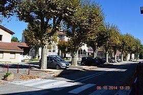 | ||
Assieu is a French commune in the Isère department in the Auvergne-Rhône-Alpes region of south-eastern France.
Contents
Map of 38150 Assieu, France
The inhabitants of the commune are known as Assieutois or Assieutoises.
Geography
Assieu is located some 30 km south by south-east of Givors and 8 km east by north-east of Saint-Maurice-l'Exil. Access to the commune is by the D131 road from the D134 in the south passing north then east in the commune to the town then north and continuing north-west to Route nationale 7. Apart from the town there is the village of La Charinaz in the east and Les Bruyeres in the west. The commune has large forests in the east as well as one in the west with significant residential areas and the rest of the land farmland.
The Vareze river forms the northern border and gathers many tributaries rising in the commune as it flows west to join the Rhône at Saint-Alban-du-Rhône.
Administration
List of Successive Mayors
(Not all data is known)
Demography
In 2010 the commune had 1,316 inhabitants. The evolution of the number of inhabitants is known from the population censuses conducted in the commune since 1793. From the 21st century, a census of communes with fewer than 10,000 inhabitants is held every five years, unlike larger towns that have a sample survey every year.
Sources : Ldh/EHESS/Cassini until 1962, INSEE database from 1968 (population without double counting and municipal population from 2006)