
Country United States FIPS code 19-03340 Elevation 430 m Zip code 51432 Local time Sunday 3:55 PM | State Iowa Time zone Central (CST) (UTC-6) GNIS feature ID 0454266 Area 47 ha Population 41 (2013) Area code 712 | |
 | ||
Weather 3°C, Wind W at 11 km/h, 62% Humidity | ||
How to say or pronounce usa cities aspinwall iowa
Aspinwall is a city in Crawford County, Iowa, United States. The population was 40 at the 2010 census.
Contents
- How to say or pronounce usa cities aspinwall iowa
- Map of Aspinwall IA USA
- Geography
- 2010 census
- 2000 census
- References
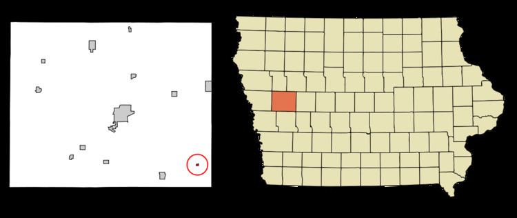
Map of Aspinwall, IA, USA
Geography
Aspinwall is located at 41°54′41″N 95°8′6″W (41.911433, -95.135036).
According to the United States Census Bureau, the city has a total area of 0.18 square miles (0.47 km2), all of it land.
2010 census
As of the census of 2010, there were 40 people, 22 households, and 12 families residing in the city. The population density was 222.2 inhabitants per square mile (85.8/km2). There were 27 housing units at an average density of 150.0 per square mile (57.9/km2). The racial makeup of the city was 100.0% White.
There were 22 households of which 13.6% had children under the age of 18 living with them, 50.0% were married couples living together, 4.5% had a male householder with no wife present, and 45.5% were non-families. 45.5% of all households were made up of individuals and 9.1% had someone living alone who was 65 years of age or older. The average household size was 1.82 and the average family size was 2.50.
The median age in the city was 55.5 years. 12.5% of residents were under the age of 18; 2.5% were between the ages of 18 and 24; 15% were from 25 to 44; 52.5% were from 45 to 64; and 17.5% were 65 years of age or older. The gender makeup of the city was 47.5% male and 52.5% female.
2000 census
As of the census of 2000, there were 58 people, 23 households, and 18 families residing in the city. The population density was 584.9 people per square mile (223.9/km²). There were 25 housing units at an average density of 252.1 per square mile (96.5/km²). The racial makeup of the city was 100.00% White.
There were 23 households out of which 30.4% had children under the age of 18 living with them, 65.2% were married couples living together, 4.3% had a female householder with no husband present, and 17.4% were non-families. 17.4% of all households were made up of individuals and 4.3% had someone living alone who was 65 years of age or older. The average household size was 2.52 and the average family size was 2.79.
In the city, the population was spread out with 22.4% under the age of 18, 8.6% from 18 to 24, 20.7% from 25 to 44, 31.0% from 45 to 64, and 17.2% who were 65 years of age or older. The median age was 44 years. For every 100 females there were 114.8 males. For every 100 females age 18 and over, there were 114.3 males.
The median income for a household in the city was $26,786, and the median income for a family was $41,250. Males had a median income of $38,750 versus $24,375 for females. The per capita income for the city was $19,835. None of the population and none of the families were below the poverty line.