
First ascent Unknown Elevation 2,645 m | Easiest route From Candanchú Prominence 501 m | |
 | ||
Similar Bisaurin, Collarada, Anayet, Pic du Midi d'Ossau, Balaïtous | ||
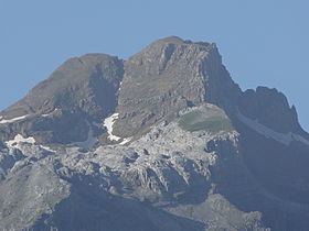
Aspe peak (also known as Pico de la Garganta de Aísa) is a mountain in the western Pyrenees of Huesca; which is situated on the west side of the Aragon Valley near the towns of Villanúa (to the south) and Canfranc (to the east). The peak is 2,645 metres (8,678 ft) AMSL high. It is adjoined to the peak of Zapatilla.
Contents
Map of Pic d'Aspe, 22728, Huesca, Spain
The peak towers over the Spanish ski resort of Candanchú and the Somport pass on the border with France. The peak gives its name to the French river Gave d'Aspe and the Aspe Valley.
Ascent routesEdit
References
Aspe peak Wikipedia(Text) CC BY-SA