
Population (2010) 1,208 Local time Sunday 9:01 PM | Intercommunality Val de Norge Area 4.55 km² | |
 | ||
Region Bourgogne-Franche-Comté Weather 7°C, Wind S at 6 km/h, 69% Humidity | ||
Asnières-lès-Dijon is a French commune in the Côte-d'Or department in the Bourgogne-Franche-Comté region of eastern France.
Contents
- Map of AsniC3A8res lC3A8s Dijon France
- Geography
- History
- Administration
- Demography
- Civil heritage
- Religious heritage
- Facilities
- References
Map of Asni%C3%A8res-l%C3%A8s-Dijon, France
The inhabitants of the commune are known as Asniérois or Asniéroises.
Geography
Asnières-lès-Dijon is located just 8 km north of Dijon. The commune lies between the D903 road which follows its western border from Dijon to Savigny-le-Sec and the D974 which follows the eastern border from Dijon and continues to Til-Châtel. The D104 links the two roads through the village and also continues east to Bellefond. The commune is mixed forest and farmland with a substantial urban area covering some 20% of the commune.
History
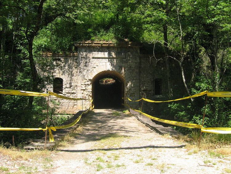
After the defeat of France in 1870-1871, Dijon was chosen with Langres, Besançon, Reims, Laon, and La Fère to be a "second line" of the Séré de Rivières system of defence (the first line being focused on Verdun, Toul, Epinal, and Belfort). A series of forts and military redoubts centred on Dijon city were built from 1875 to 1883: la Motte-Giron, Mont-Afrique, Hauteville, Asnières, Norges, Var, Saint-Apollinaire, and Sennecey-lès-Dijon.
Built between 1876 and 1877, Fort Brûlé had the honour of suffering the first armed clash with Prussia.
Fort Brûlé did not defend Dijon during the two world wars. It was the Germans who used it as a storehouse for ammunition during the Second World War. These caused considerable damage in 1944 when the Germans blew up ammunition in the fort: so much so that with the exception of the protruding buttress on Saliant II, there is virtually nothing left of the left half of the fort.
The fort is now the property of a private owner.
The commune has had a very high level of population growth since the 1970s when it was a peaceful farming village. Many employees from the CEA at Valduc came to live there. The population of the commune increased six times in 40 years.
Administration
List of Successive Mayors
(Not all data is known)
Demography
In 2010 the commune had 1,208 inhabitants. The evolution of the number of inhabitants is known from the population censuses conducted in the commune since 1793. From the 21st century, a census of communes with fewer than 10,000 inhabitants is held every five years, unlike larger towns that have a sample survey every year.
Sources : Ldh/EHESS/Cassini until 1962, INSEE database from 1968 (population without double counting and municipal population from 2006)
The commune is part of the community of communes of Val de Norge .
Civil heritage
The commune has two sites which are registered as historical monuments. These are:
Religious heritage
Facilities
Asnières has shops (bakery, butcher, a small hall, and a petting zoo) and various facilities including a hall and sports grounds (tennis, football, basketball, rugby). The town also has a nursery and primary school.
It also has a Judo club - the Entente Judo Messigny-et-Vantoux - Val de Norge (Ejmn)