
Population 351 (2011) Sovereign state United Kingdom Dialling code 01904 | OS grid reference SE536480 Local time Sunday 7:19 PM | |
 | ||
Weather 11°C, Wind SW at 32 km/h, 75% Humidity | ||
Askham Richard is a village and civil parish in the unitary authority of City of York in the north of England, six and a half miles south-west of York, close to Copmanthorpe, Bilbrough and Askham Bryan. The population of the civil parish at the 2011 Census was 351. Prior to 1996 it formed part of the district of Selby. The village became a Conservation Area in 1975. Nearby is Askham Bryan College of Agriculture.
Contents
- Map of Askham Richard York UK
- History
- Governance
- Demography
- Geography
- Economy
- Transport
- Education
- Religious sites
- References
Map of Askham Richard, York, UK
History
The village is mentioned in the Domesday Book. The name comes from ascam or ascha meaning "enclosure of ash-tree". It has been also known as "Little" or "West" Askham". The "Richard" in the village name is reputed to be that of Richard, 1st Earl of Cornwall.
The villages of Askham Richard and close-by Askham Bryan were once just one manor around the time of Edward the Confessor and belonged to Edwin, Earl of Mercia. When Edwin's lands were confiscated by the William the Conqueror, the village was granted to Roger de Mowbray who then passed the Manor to his friend, William de Tykhill, a former Warden of Foss Bridge.
Governance
Askham Bryan lies in the Rural West York Ward of the City of York Unitary Authority. As of the 2011 elections it is represented by Councillors Ian Gillies, Paul Healey and Chris Steward who are all members of the local Conservative Party. It is also a part of the UK Parliamentary Constituency of York Outer as well as the EU region of Yorkshire and the Humber.
Demography
According to the 2001 census the parish had a population of 273. In 1848, parish records show the population as 232. In 1881, the National Census showed the population as 226.
Geography
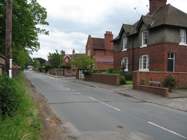
The village consists of one main street, where the main village green and duck pond are located, and a couple of small lanes. The soil consists of gravel and clay.
The village is 1.7 miles west of Askham Bryan, 2.3 miles south of Rufforth, 1.5 miles north-east of Bilbrough.
Economy
Within the village is Her Majesty's Prison Askham Grange. Also in the village is the Rose and Crown pub. There are three farms, but the remainder are dwellings. The nearby Askham Bryan College of Agriculture and Horticulture provides some local employment.
Transport
Utopia coaches service 37 stops in the village which is on the Tadcaster to York route.
Education
Primary education is catered for at St. Mary Church of England primary school. Nearby is Askham Bryan College of Agriculture and Horticulture. The college was originally known as the Yorkshire Institute of Agriculture, which opened in 1948. It became Askham Bryan College of Agriculture and Horticulture 19 years later. It now includes equine management, animal management, land management, business, food production, engineering and bioscience.
Religious sites
The Norman-styled church is dedicated to St Mary and was partly rebuilt in 1887. The church is Grade II* listed, and there is record of a church as far back as 1086.