
Airport type Public 12/30 3,603 Elevation 574 m | Owner City of Ashland Elevation AMSL 1,885 ft / 575 m 3,603 1,098 Phone +1 541-482-7675 | |
 | ||
Address 403 Dead Indian Memorial Rd, Ashland, OR 97520, USA Similar Cascade Airport Shuttle, Oregon Shakesp Festival, Rogue Valley Internatio, Shawn's Rideshare, Ashland | ||
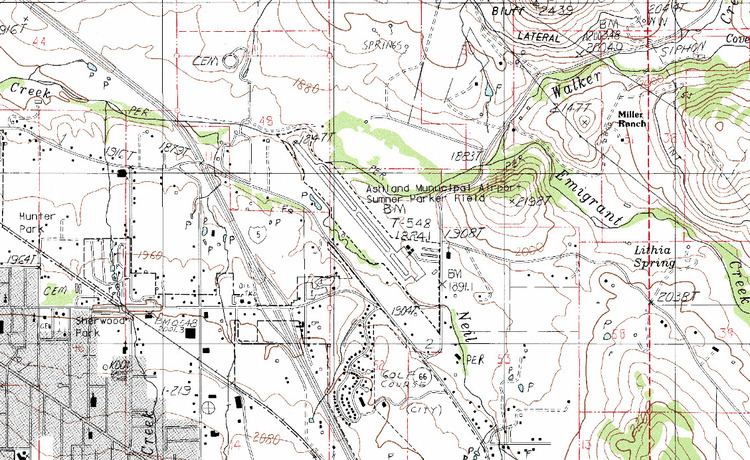
Ashland Municipal Airport, also known as Sumner Parker Field (IATA: AHM, FAA LID: S03), is two miles east of Ashland, in Jackson County, Oregon. The National Plan of Integrated Airport Systems for 2011 through 2015 categorized it as a general aviation facility.
Facilities
The airport covers 94 acres (38 ha) at an elevation of 1,885 feet (575 m). Its one runway, 12/30, is 3,603 by 75 feet (1,098 x 23 m) asphalt.
In the year ending April 10, 2012 the airport had 26,050 aircraft operations, average 71 per day: 94% general aviation, 6% air taxi, and <1% military. 62 aircraft were then based at this airport: 79% single-engine, 8% helicopter, 6.5% multi-engine, and 6.5% ultralight.
References
Ashland Municipal Airport Wikipedia(Text) CC BY-SA