
Country Japan Area 865 km² Local time Sunday 11:03 PM | Region Hokkaido Population 17,984 (30 Jun 2008) University Seisa University | |
 | ||
Prefecture Hokkaido (Sorachi Subprefecture) Time zone Japan Standard Time (UTC+9) City hall address 1-3 Kita-ichijō Higashi, Ashibetsu-shi, Hokkaidō
075-8711 Website www.city.ashibetsu.hokkaido.jp Weather -15°C, Wind SE at 3 km/h, 92% Humidity | ||
Ashibetsu (芦別市, Ashibetsu-shi) is a city located in Sorachi Subprefecture, Hokkaido, Japan.
Contents
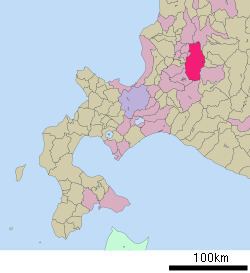
- Map of Ashibetsu Hokkaido Prefecture Japan
- History
- Geography
- Name
- University
- college
- Public
- Private
- Transportation
- Sister city
- References
Map of Ashibetsu, Hokkaido Prefecture, Japan
As of 2008, the city has an estimated population of 17,984 and a density of 20.8 persons per km2. The total area is 865.02 km2.
History
The city was once a prosperous coal mining city, its population exceeding 70,000 at its peak, but its population has fallen since the closing of the coal mines.
Geography
Ashibetsu is located in the northern part of Yūbari Mountains. Mount Ashibetsu is located on south of the city.
Name
There are two theories about the origin of "Ashibetu". In both theories the river means Ashibetsu River, which flows through in the city.
University
college
Public
Private
Transportation
Sister city
References
Ashibetsu, Hokkaido Wikipedia(Text) CC BY-SA