
OS grid reference SU5676 Sovereign state United Kingdom Dialling code 01635 | Local time Sunday 12:41 PM | |
 | ||
Population 398 (2001 census)392 (2011 Census) Weather 10°C, Wind SW at 29 km/h, 77% Humidity | ||
Woodway ridgeway aldworth ashampstead hampstead norris east ilsley blewbury xvid 6 avi
Ashampstead is a small village and civil parish in the rural area between Reading, Newbury and Streatley in Berkshire, England. The parish population is about 400, occupying some 150 dwellings.
Contents
- Woodway ridgeway aldworth ashampstead hampstead norris east ilsley blewbury xvid 6 avi
- Map of Ashampstead Reading UK
- History
- Local government
- References
Map of Ashampstead, Reading, UK
History
The village was called Esshamstede in the 13th and 14th centuries.
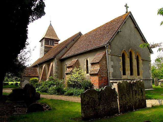
The Church of England parish church of Saint Clement dates from the 12th century. It has 13th century frescoes and a 15th-century wooden bell turret. It is believed the frescoes may have been commissioned from Lyre Abbey in Normandy, France. The only remaining bell dates from 1662.
Local government
Ashampstead is a civil parish in the area of West Berkshire unitary authority.
References
Ashampstead Wikipedia(Text) CC BY-SA