
Population 5,686 (2011 census) Area 3.62 km² Local time Sunday 12:27 PM | OS grid reference SU891524 Sovereign state United Kingdom District Borough of Guildford | |
 | ||
Weather 11°C, Wind SW at 29 km/h, 78% Humidity | ||
Willow park fishery ash vale hampshire anglers mail tactical briefings
Ash Vale is a village in the borough of Guildford in Surrey, England and the larger, northern settlement of the civil parish of Ash. It is 7 miles (11 km) from Guildford but is closer to the Hampshire towns of Aldershot and Farnborough, the centres of which are each about two miles (4 km) away, immediately across the two crossings of the River Blackwater, to the southwest and northwest.
Contents
- Willow park fishery ash vale hampshire anglers mail tactical briefings
- Map of Ash Vale UK
- Ash vale tandoori aldershot reviews 01252 334046 facebook reviews ash vale tandoori aldershot
- Geography
- Environment
- History
- Economy and Amenities
- Youth outreach
- Famous residents
- References
Map of Ash Vale, UK
Ash vale tandoori aldershot reviews 01252 334046 facebook reviews ash vale tandoori aldershot
Geography
Ash Vale's extent is on two sides clearly demarcated, by the river to the west and at a few locks' higher elevation by the parallel Basingstoke Canal to the east – across these boundaries are, respectively, Aldershot Garrison (Military Town) and the large Surrey Heath MoD, mostly UK Army, ranges and training areas. The latter is a co-managed County Wildlife Site, for instance Ash Ranges at 2,439 acres (987 ha) and Pirbright Ranges at 2,765 acres (1,119 ha), with various access days and parts (see the Wildlife's Trust website). The type of soil of the east, the heath is very acidic, sandy and loamy which makes up just 1.9% of English soil and 0.2% of Welsh soil, which gives rise to pines and coniferous landscapes, such as pioneered at Wentworth and Foxhills estate and is good for biodiversity.
Two branch railway lines cross in the middle of the village without forming a junction. In the north of the village are Ash Vale railway station and North Camp railway station, on the London-Aldershot-Alton Line and the Reading-Guildford-Gatwick Line respectively. In addition, trains run through Ash Vale from Guildford to Ascot via Aldershot. The village owes its development to the Garrison and to the railways; see the description of the often heath soil under the Ash article, explaining how to the south lies a limited area of fertile farming country.
A Tesco Express store opened in Lysons Avenue, opposite the railway station opened on 12 October 2012.
Environment
Air pollution is low, with no Air Quality Management Areas in this borough or that immediately adjoining, Rushmoor. Drainage is good, the whole draining westward by the gentle valley of the upper Blackwater. In eastern parts distant ordnance fire can be heard from Ash ranges and occasional light aircraft on various tracks over the village take off from Farnborough Airport approximately three miles west.
History
See History of Ash, Surrey.
Economy and Amenities
An increased proportion of the village's population relies on the half-hourly 40-minute railway connection to Waterloo as well as providing local services and the small semi-military community of the post-war era has become a largely commuter settlement. While 417 employed residents worked at/from home in 2001, the remaining 1306 commuted, of which 682 responded they commuted less than 5 kilometres (3.1 mi).
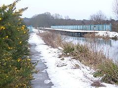
Holly Lodge (Primary) School is next to Carrington Park, which has playground facilities and its footpath provides a less residential route between North Camp Station and Mytchett lake and Basingstoke Canal Visitor Centre on the Basingstoke Canal. The canal's towpath runs through the village. Within the park are recycling facilities. The Keogh Barracks on the Ash Ranges are in the ward boundaries. Parks and Nature reserves in Ash Vale:
South of the village are:
Youth outreach
The Normandy Youth Center serves the area by sponsoring community-based programs targeting youth in the area (especially marginal groups and minorities) for the purpose of increasing exposure to educational opportunities and building a stronger community.