
Prefecture Kanagawa Population 167,792 (Mar 2010) | Region Kantō Area 23.28 km² Local time Sunday 6:40 PM | |
 | ||
Time zone Japan Standard Time (UTC+9) Website www.city.kawasaki.jp/73/73soumu/index.htm Weather 8°C, Wind W at 14 km/h, 72% Humidity Colleges and Universities | ||
Asao-ku (麻生区) is one of the 7 wards of the city of Kawasaki in Kanagawa Prefecture, Japan. As of 2010, the ward had an estimated population of 167,792 and a density of 7,210 persons per km². The total area was 23.28 km².
Contents
- Map of Asao Ward Kawasaki Kanagawa Prefecture Japan
- Geography
- Surrounding municipalities
- History
- Economy
- Company headquarters
- Railroads
- Prefecture roads
- Education
- Noted people from Asao Ward
- References
Map of Asao Ward, Kawasaki, Kanagawa Prefecture, Japan
Geography
Asao Ward is located in eastern Kanagawa Prefecture, in the far western corner of the city of Kawasaki, bordering on Tokyo. It is bordered to the north by the Tama River. In March 1913, a fossil tooth from a Parastegodon (similar to the Stegodon genus) was found in what is now Yurigaoka 2-19 in the upper sedimentary layers of mudstone. It is thought to have been from the late Pliocene period. Most of what is now the city of Kawasaki was under water during this period, so the fossil indicates that the Asao area was above water and perhaps marked the shoreline.
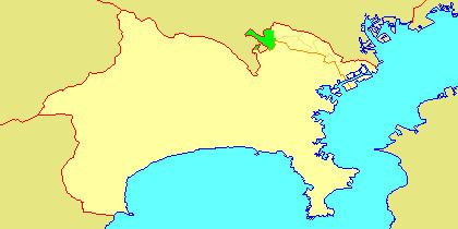
Surrounding municipalities
History
Rice was grown in the area as early as the Yayoi period. The name “Asao” appears in Heian period records, and as the name implies, the area was noted for its production of hemp. Under Ritsuryō system, it was part of Musashi Province. By the Edo period It was administered as tenryō territory controlled directly by the Tokugawa shogunate, but administered through various hatamoto, and was noted for its production of charcoal. After the Meiji Restoration, the area was divided between Tachibana District and Tsuzuki District in the new Kanagawa Prefecture on April 1, 1889. These areas were annexed by the neighboring city of Kawasaki from 1938-1939.
The area became part of a huge government sponsored housing project from the 1950s and 1960s, resulting in the Yurigaoka Danchi and other suburban developments. The area became part of Tama Ward with the division of the city of Kawasaki into wards from April 1972. In July 1982, Asao Ward was separated from Tama Ward. A new Ward Office was completed in 1997.
Economy
Asao Ward is largely a regional commercial center and bedroom community for central Kawasaki and Tokyo. Traditionally (through the Meiji period, the area was known for its production of Japanese persimmons.