
Country United States Time zone CST (UTC-6) Area 148.7 km² Population 945 (2010) | Established Before 1921 Elevation 208 m Local time Saturday 5:46 AM | |
 | ||
ZIP codes 60918, 60924, 60955, 60968 Weather -3°C, Wind W at 34 km/h, 82% Humidity | ||
Artesia Township is one of twenty-six townships in Iroquois County, Illinois, USA. As of the 2010 census, its population was 945 and it contained 428 housing units. Artesia Township formed from portions of Ash Grove and Loda townships sometime prior to 1921.
Contents
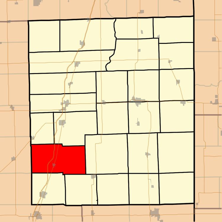
- Map of Artesia Township IL USA
- Geography
- Cities towns villages
- Cemeteries
- Major highways
- School districts
- Political districts
- References
Map of Artesia Township, IL, USA
Geography
According to the 2010 census, the township has a total area of 57.42 square miles (148.7 km2), of which 57.36 square miles (148.6 km2) (or 99.90%) is land and 0.06 square miles (0.16 km2) (or 0.10%) is water.
Cities, towns, villages
Cemeteries
The township contains these two cemeteries: Lisk and Saint John's Lutheran.
Major highways
School districts
Political districts
References
Artesia Township, Iroquois County, Illinois Wikipedia(Text) CC BY-SA