
Intercommunality Pays de May Area 13.47 km² | Population (2010) 791 Local time Thursday 1:47 AM | |
 | ||
Weather 8°C, Wind SE at 6 km/h, 77% Humidity | ||
Arros-de-Nay (Occitan: Arròs de Nai) is a French commune in the Pyrénées-Atlantiques department in the Nouvelle-Aquitaine region of south-western France.
Contents
- Map of 64800 Arros de Nay France
- Geography
- Toponymy
- History
- Administration
- Inter communality
- Demography
- Economy
- Civil heritage
- Religious heritage
- Education
- References
Map of 64800 Arros-de-Nay, France
The inhabitants of the commune are known as Arrosiens or Arrosiennes
Geography
Arros-de-Nay is part of the urban area of Pau located in the heart of a valley between wooded hills and the Gave de Pau some 13 km south-east of Pau immediately east of Nay. The commune has been administered by the department of Pyrénées-Atlantiques since 1969 (formerly it had been in the Department of Basses-Pyrénées since 1793). The commune has about 300 houses. The altitude varies from 230 metres to 421 metres, with 243 metres in the village centre. This is one of the largest communal areas of the region with areas of plains and hilly areas with a livable areas in the north and in the hamlets.
Access to the commune is by road D37 from Saint-Abit in the north passing through the village and the northern corner of the commune continuing to Bourdettes in the south. The D936 goes west from the village then south-west to Rébénacq. The D288 road goes south from the village through the length of the commune to join the D287 north of Lys. The D388 branches from the D288 and goes south-west by a different route to join the D288 again south-west of the commune. The D287 goes south-west from Nay passing along the south-eastern border of the commune and continuing south-west to Sévignacq-Meyracq.
The commune is located in the Drainage basin of the Adour with the Luz flowing from the south through the length of the commune collecting many tributaries and continuing north to join the Gave de Pau near Narcastet. The Escourre flows north through the northern corner of the commune and the north-eastern tip of the commune touches the Gave de Pau.
Toponymy
The commune name in béarnais is Arros de Nai.
Michel Grosclaude, with much reservation, suggested an Aquitaine root of (h)arr ("stone" or "rock") with the suffix -ossum, which gives a meaning "where there are rocks".
The following table details the origins of the commune name and other names in the commune.
Sources:
Origins:
On 27 January 1932 the prefect, citing consecutive administrative mistakes from the plurality of the name Arros in the department (Arros Canton of Nay, Arros Canton of Oloron), decided to associate the name of the chief town of the canton with that of the commune and asked the Municipal Council to endorse his decision. The council of the time complied and the name became Arros-de-Nay.
History
The first traces of the village date to the 11th century when it was cited with the name Arrossium ("place where there are rocks"). In the 12th century a noble family (de Rode, d’Arrode, then d’Arros) who owned the Lordships of Rode, Vauzé, the Viguerie of Lembeye took possession of the fief which became Arrode then later Arros.
Paul Raymond noted that, in 1385, Arros had 44 fires and depended on the bailiwick of Pau. Arros, with its hamlets towards Bosdarros ('Bois d’Arros'), was the seventh largest of the twelve large Baronies of Béarn.
Administration
List of Successive Mayors
(Not all data is known)
Inter-communality
The commune is part of seven inter-communal structures:
Demography
In 2010 the commune had 791 inhabitants. The evolution of the number of inhabitants is known from the population censuses conducted in the commune since 1793. From the 21st century, a census of communes with fewer than 10,000 inhabitants is held every five years, unlike larger towns that have a sample survey every year.
Sources : Ldh/EHESS/Cassini until 1962, INSEE database from 1968 (population without double counting and municipal population from 2006)
Economy
The commune is part of the Appellation d'origine contrôlée (AOC) zone designation of Ossau-iraty.
Civil heritage
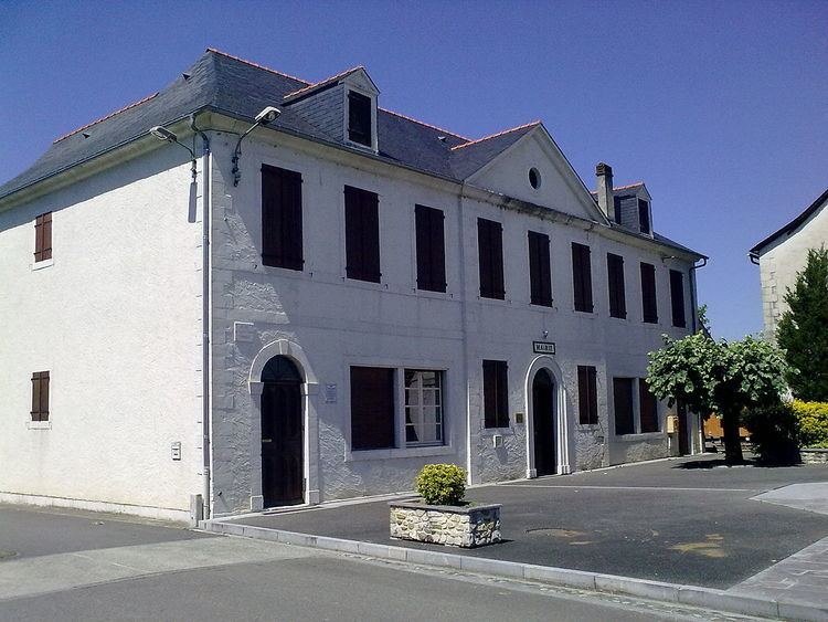
The Chateau of Arros (17th century) is registered as an historical monument.
Religious heritage
Education
Arros-de-Nay has a primary school.