
Population (2009) 66 | Intercommunality Montbardois Area 10.52 km² | |
 | ||
Region Bourgogne-Franche-Comté | ||
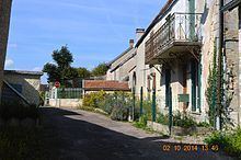
Arrans is a French commune in the Côte-d'Or department in the Bourgogne-Franche-Comté region of eastern France.
Contents
Map of 21500 Arrans, France
Geography
Arrans is located some 6 km north of Montbard and 5 km south-east of Asnières-en-Montagne. Access to the commune is by the D5 road from Montbard in the south which passes through the heart of the commune and the village and continues north to Verdonnet. The D119 road also links the village to Asnières-en-Montagne in the north-west. The D5E branches off the D5 in the commune and goes south-west to Saint-Rémy. The commune is mostly forest with farmland around and east of the village.
Administration
List of Successive Mayors
(Not all data is known)
Demography
In 2009 the commune had 66 inhabitants. The evolution of the number of inhabitants is known from the population censuses conducted in the commune since 1793. From the 21st century, a census of communes with fewer than 10,000 inhabitants is held every five years, unlike larger towns that have a sample survey every year.
Sources : Ldh/EHESS/Cassini until 1962, INSEE database from 1968 (population without double counting and municipal population from 2006)
Religious heritage
The Parish Church of Saint-Pierre-Célestin contains 2 Monumental Paintings of Saint Ambroise and Saint Nicolas (16th century) that are registered as an historical object.