
Country Turkey Province Mersin Time zone EET (UTC+2) Population 6,010 (2012) | Region Mediterranean District Erdemli Postal code 33360 | |
 | ||
Arpaçbahşiş is a town in Erdemli district of Mersin Province, Turkey.
Contents
- Map of ArpaC3A7bahC59FiC59F ArpaC3A7bahC59FiC59F Mahallesi 33730 Erdemli2FMersin Province Turkey
- Geography
- History
- Economy
- References
Map of Arpa%C3%A7bah%C5%9Fi%C5%9F, Arpa%C3%A7bah%C5%9Fi%C5%9F Mahallesi, 33730 Erdemli%2FMersin Province, Turkey
Geography
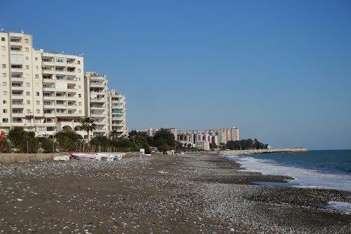
Although the original settlement is 2 km (1.2 mi) north of the Mediterranean coast, the newer quarters of the town are being established at the coastal band. Arpaçbahşiş is located between Mersin and Erdemli, the distance to Erdemli is 5 km (3.1 mi) and to Mersin is 30 km (19 mi). The population is 6,010 as of 2012.
History
The area around Arpaçbahşiş was a part of historical Cilicia Pedias (eastern part of Cilicia, the flat Cilicia). During the domination of Ramadanid principality (a Turkmen dynasty between 13th and 16th centuries), a Turkmen tribe named Varsak settled in the area, north of the modern town of Tömük, several kilometers northeast of Arpaçbahşiş. At about 1375, a certain Elvan Bey of Varsak began controlling the area around Arpaçbahşiş. But the settlement was established much later; probably at the beginning of the 18th century, during the Ottoman era. Sarıkeçili, a Turkmen tribe from Konya, a city in central Anatolia, settled in the area. The town was named after Arpaç Hüseyin, the chief of the Sarıkeçili tribe.
In 1865, the settlement was established as a village of Mersin. In 1970, the village of Arpaçbahşiş was declared a town.
Economy
Like most towns around, Arpaçbahşiş is an agricultural town specialized in citrus. But, lately the coastal band of Arpaçbahşiş became a summer resort. It is populated by summer houses, and services to summer houses constitute an ever increasing revenue for the town.