
Area 28.82 km² Local time Wednesday 2:20 PM | Region Occitanie Time zone CET (UTC+1) Population 2,728 (2010) | |
 | ||
Weather 17°C, Wind SE at 6 km/h, 45% Humidity | ||
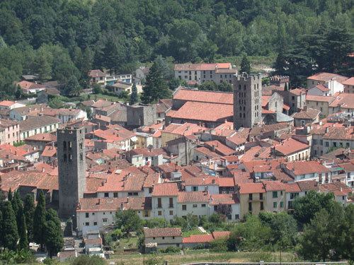
Arles-sur-Tech (Catalan: Arles de Tec) is a commune in the Pyrénées-Orientales department in southern France.
Contents
Map of 66150 Arles, France
Localisation
Arles-sur-Tech is located in the canton of Arles-sur-Tech and in the arrondissement of Céret.
Arles-sur-Tech is situated in the southernmost valley in mainland France before Spain, the Vallespir, through which the 84 km (52 mi) long river "Tech" flows. This small town is surrounded by the eastern Pyrenees which dominate skyline around Arles-sur-Tech. The town sits on the only main road which passes through the valley, the D 115, making it accessible from Spain in the west and the plane of Roussillon and Perpignan in the east. It is located close to the larger and more well-known spa town of Amélie-les-Bains-Palalda.
International relations
Arles-sur-Tech is twinned with: