
Length 15.48 km | South end: AR 12 Constructed 24 April 1963 | |
 | ||
Existed: April 24, 1963 – present South end: CR 192 Lollar's Creek Rd. | ||
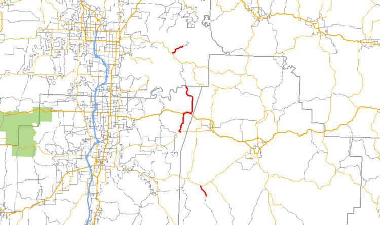
Highway 303 (AR 303, Ark. 303, and Hwy. 303) is a designation for three north–south state highways in northwest Arkansas. A southern route of 1.86 miles (2.99 km) runs north from Lollar's Creek Road (Madison County Road 192 [CR 192]) to Highway 74. A second route of 9.62 miles (15.48 km) begins at Highway 45 at Mayfield and runs north to the Benton County line. A third segment of 2.27 miles (3.65 km) begins at Highway 12 and runs north to Rocky Branch Road near Beaver Lake.
Contents
- Map of AR 303 Rogers AR 72756 USA
- Madison County
- Mayfield to Benton County
- Beaver Lake
- History
- References
Map of AR-303, Rogers, AR 72756, USA
Madison County
Highway 303 begins at Lollar's Creek Road (Madison CR 192) and runs northwest to terminate at Highway 74 east of Wesley.
Mayfield to Benton County
Highway 303 begins at Highway 45 at Mayfield and runs north through unincorporated Washington County to meet US Route 412 at Spring Valley. The two routes participate in a 1 mile (1.6 km) concurrency east until Highway 303 turns north from US 412 near the Madison County line. The route then runs north towards War Eagle and becomes Benton CR 98 which eventually gives access to Highway 12 near Beaver Lake.
Beaver Lake
Highway 303 begins at Highway 12, angling northeast before terminating at Rocky Branch Road (Benton CR 99) near Beaver Lake.
History
Highway 303 was added to the state highway system as part of a large transfer of county roads to the state system that took place on April 24, 1963. Initially only the portion from Mayfield to the Benton County line was transferred to state maintenance.