
South end: AR 36 North end: AR 16 – Pangburn | Length 36.7 km | |
 | ||
South end: | ||
Arkansas Highway 107 is the name of multiple state highways in Arkansas.
Contents
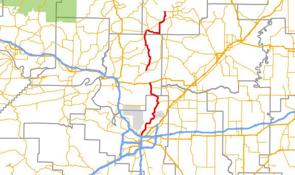
Map of AR-107, Arkansas, USA
Section 1
Arkansas Highway 107 is a state highway of 33.2 miles (53.4 km) that runs in Faulkner and Cleburne counties.
Route description
AR 107 begins at AR 36 near Holland. The route runs north to meet AR 25 and AR 225 before entering Quitman and Cleburne County. In Quitman, AR 25 also meets AR 124, which it follows east out of town. After breaking north, AR 107 reunites with AR 25 north to an area just south of Heber Springs. AR 107 ends at AR 110 in Heber Springs. AR 107 has 16.2 miles (26.1 km) in Faulkner County and 17.0 miles (27.4 km) in Cleburne County.
Section 2
Arkansas Highway 107 is a state highway of 18.7 miles (30.1 km) that runs in Pulaski and Faulkner counties.
Route description
AR 107 begins at Interstate 40 in North Little Rock and runs through some suburbs until entering Faulkner County. The route runs north to terminate at US 64 in Vilonia. AR 107 has 16.4 miles (26.4 km) in Pulaski County and 6.4 miles (10.3 km) in Faulkner County.