
Existed: 1970 – present 160 SR 164 → 279 SR 280 → Constructed 1970 | West end: SR 89A in Cottonwood 173 SR 176 → Length 350.5 km | |
 | ||
East end: US 180 / US 191 in Eagar | ||
Arizona state route 260 west past kohl s ranch toward payson az 17 july 2015 gp118827
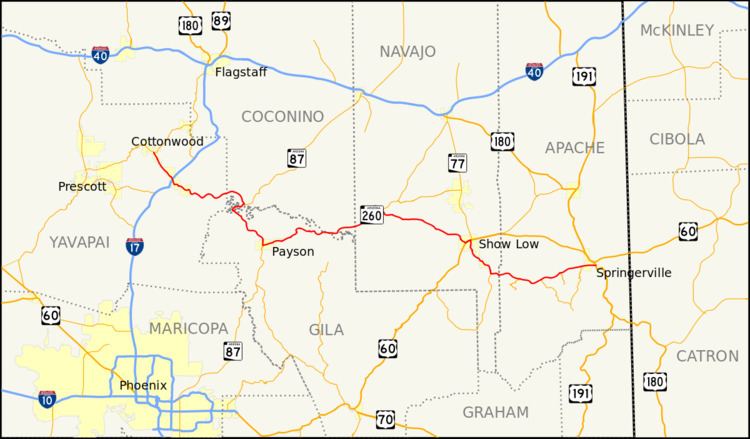
State Route 260, also known as SR 260, is a major east–west state highway in north-central part of the U.S. state of Arizona. It connects State Route 89A in Cottonwood to U.S. Route 180 and U.S. Route 191 in Eagar.
Contents
- Arizona state route 260 west past kohl s ranch toward payson az 17 july 2015 gp118827
- Map of AZ 260 Arizona USA
- Route description
- References
Map of AZ-260, Arizona, USA
Route description
The western terminus of SR 260 is located at State Route 89A in Cottonwood and heads eastbound along much of the Mogollon Rim, finally ending at its junction with U.S. Route 180 and U.S. Route 191 in Eagar. SR 260 is part of the National Highway System between Show Low and Payson.
Stretches of this highway are known by various names, include Camp Verde Bridgeport Highway, General George Crook Trail, Camp Verde-Payson Highway, and White Mountain Road / Boulevard. The northernmost stretch between Cottonwood and Camp Verde was originally State Route 279, while the original stretch of road from Payson to Eagar was originally State Route 160.
SR 260 has been widened and upgraded between Payson and Heber-Overgaard to a four lane divided highway with bridges over wildlife corridors to reduce accidents with deer/elk and other wildlife. The road is congested at times during holiday weekends with traffic from the Phoenix area to areas along the eastern Rim. It is also closed during winter storms because of its elevation changes between Payson and Show Low.