
Existed: 1986 – present Constructed 1986 | Length 32.62 km | |
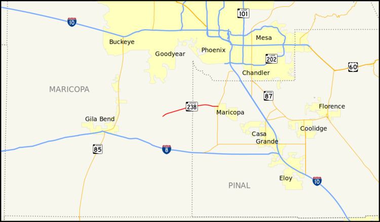 | ||
State Route 238, also known as SR 238, is an east–west state highway in central Arizona.
Contents
Map of AZ-238, Maricopa, AZ, USA
Route description
While the mile markers indicate a start in Gila Bend, the highway is not actually part of the State Highway System until 11 miles (17.70 km) west of the Maricopa/Pinal County line near Mobile, at Mile Marker 24. The road west of this point is actually a county route. This stretch of road is known as Maricopa Road (except for a brief portion signed as Smith Enke Road within the town of Maricopa) and serves as a direct route between the two towns as well as an access road for the Sonoran Desert National Monument. It was originally a dirt road from Gila Bend to Maricopa, it was upgraded to a state highway to serve a proposed hazardous waste management facility west of Mobile. The official State Highway map shows this road terminating at Maricopa at the junction with State Route 347. Since its upgrade to a paved highway, this road has become a common shortcut for residents of the southern part of the Phoenix Metro Area travelling to Yuma and San Diego.
Some road maps show a continuation of the route eastbound; after briefly overlapping a short southbound stretch of State Route 347 (also, confusingly, known as Maricopa Road or the John Wayne Parkway), the highway beelines southeast to its eastern terminus at Casa Grande; this stretch of the highway is known as the Maricopa-Casa Grande Highway. According to ADOT, this section of road is not currently commissioned [1].
Virtually the entire road follows the Southern Pacific Railroad line, with brief detours at the Maricopa and Casa Grande townsites.
Junction list
The highway begins on Maricopa Road, MP 24.