
Elevation 1,684 m (5,525 ft) Time zone CET (UTC+1) Local time Tuesday 9:49 PM Postal code 12010 Dialling code 0171 | Demonym(s) Argentesi or Argenters Area 77.7 km² | |
 | ||
Frazioni Bersezio (municipal seat), Ferrere, Le Grange and Severagno (ruinied boroughs), Villaggio Primavera, Prinardo, Serre Weather -4°C, Wind W at 23 km/h, 87% Humidity | ||
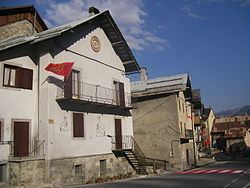
Argentera is a comune (municipality) in the Province of Cuneo in the Italian region Piedmont, located about 100 kilometres (62 mi) southwest of Turin and about 60 kilometres (37 mi) west of Cuneo, on the border with France. It consists of a series of sparse hamlets in the upper Valle Stura di Demonte. The municipal seat is in Bersezio, on the road to the Maddalena Pass.
Map of 12010 Argentera, Province of Cuneo, Italy
Argentera borders the following municipalities: Acceglio, Canosio, Larche (France), Pietraporzio, and Saint-Etienne-de-Tinée (France). Its territory includes peaks such as the Oserot at an elevation of 2,860 metres (9,380 ft) above sea level, Enciastraia at 2,955 metres (9,695 ft) and the Rocca dei Tre Vescovi at 2,867 metres (9,406 ft).
References
Argentera Wikipedia(Text) CC BY-SA