
Primary outflows Miass River Surface area 102 km (39 sq mi) Area 102 km² Inflow source Miass River | Primary inflows Average depth 6.5 m (21 ft) Mean depth 6.5 m Outflow location Miass River | |
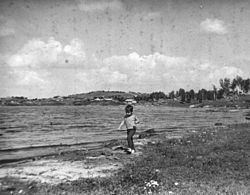 | ||
Argazi Reservoir (Russian: Аргазинское водохранилище) is a reservoir, created on the Miass River (Tobol's basin) in Chelyabinsk Oblast (Russia) in 1946. The Argazi Lake has become a part of the Argazi Reservoir ever since. The reservoir has a surface area of 102 km² and a water volume of 0,65 cubic km. Its length is 11 km, average depth - 6,5 m. The Argazi Reservoir was created for the benefit of energetics and water supply. It also performs perennial flow regulation.
Contents
Map of Argazi Reservoir, Chelyabinsk Oblast, Russia
Name
Argazi Reservoir name is taken from the Bashkirs (Bashkir: Арғужа), the indigenous inhabitants of these places. This article includes content derived from the Great Soviet Encyclopedia, 1969–1978, which is partially in the public domain.
Reservoir in culture
There is Bashkir folk song about Argazi lake (Bashkir: Арғужа ) later became a reservoir.