
Local time Wednesday 2:16 AM | Zone Lumbini Zone Time zone Nepal Time (UTC+5:45) Population 2,729 (1991) | |
 | ||
Weather 15°C, Wind N at 0 km/h, 73% Humidity Neighborhoods Pujeri Gaun, Purana Gau, Kuseni, Artunga, Chaatiwan, Ranuwa, Ravidas, Deurali Bazzar, Sacha, Fosran | ||
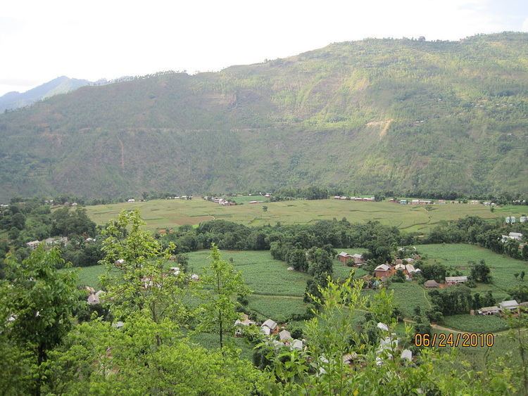
Argali is a village development committee in Palpa District in the Lumbini Zone of southern Nepal. At the time of the 1991 Nepal census it had a population of 2729 people living in 511 individual households.
Map of Argali, Nepal
Argali is a plain area between the mountain where around more than 2000 people live. Khya village is in the west of argali and kalipar village in the west. Kaligandaki flows near the Argali. Historical Rana‘s palace is also there in Argali which have been turned to school now. Argali is a beautiful place where there is access of transportation, communication and electricity. The famous Rishikesh temple and Ridi Bazaar is only 5 km away from Argali.
References
Argali, Palpa Wikipedia(Text) CC BY-SA