
Postal code 20550 Area 29.13 km² | Autonomous community Basque Country Time zone CET (UTC+1) Elevation 260 m Local time Tuesday 9:18 PM | |
 | ||
Weather 7°C, Wind SW at 3 km/h, 85% Humidity | ||
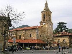
Aretxabaleta is a town in the province of Gipuzkoa, in the Autonomous Community of Basque Country, northern Spain.
Contents
Map of 20550 Aretxabaleta, Guip%C3%BAzcoa, Spain
It is located on the Bergara road, almost adjacent to its larger northern neighbor, the city of Arrasate, and the smaller Eskoriatza to the south.
The place name
In the past, the Basque name "Aretxabaleta" was commonly used, both in Spanish and in English with the Spanish spelling, Arechavaleta. The local government (ayuntamiento) decided to officially change the spelling to the Basque "Aretxabaleta" on June 4, 1979. Their decision was authorized by Spanish central government on March 3, 1981.
References
Aretxabaleta Wikipedia(Text) CC BY-SA