
District Purvi Champaran Telephone code 91 6258 Population 20,245 (2001) | Time zone IST (UTC+5:30) Lok Sabha constituency Purvi Champaran Local time Wednesday 1:35 AM | |
 | ||
Weather 17°C, Wind S at 0 km/h, 62% Humidity | ||
My areraj appeal for downtrodden student santosh
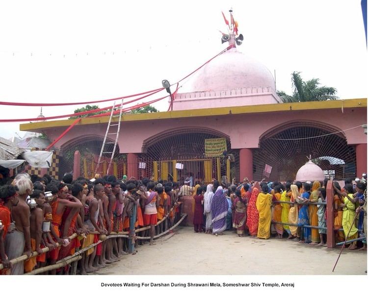
Areraj (Hindi: अरेराज) is a town and a notified area in East Champaran district in the state of Bihar, India.
Contents
- My areraj appeal for downtrodden student santosh
- Map of Areraj Bihar 845411
- Geography
- Demographics
- References
Map of Areraj, Bihar 845411
Geography
Areraj is located at 26°33′01″N 84°40′48″E.
It is just 30KM away from Motihari. No train route is available to reach here, So to reach here one has to go by roadways only. Bus frequency is very good as after every 25minutes(approximately) there is one bus for Areraj. Its takes around 30-35 minutes to reach Areraj.There is no traffic on the way to Areraj. Kesariya where WORLD'S HIGHEST STUPA is situated is just 40km from here.
Demographics
As of 2011 India census, Areraj had a population of 26,014 with males constituting 52% of the population and females 48%. Areraj has an average literacy rate of 45%, lower than the national average of 59.5%; with 64% of males and 36% of females literate. 20% of the population is under 6 years of age.Areraj is going to connect on Indian Railway MAP through Hajipur-Sagauli proposed rail line.