
Surface area 5.14 km (1.98 sq mi) Max. depth 50 m (160 ft) Area 5.14 km² Mean depth 29 m | Average depth 29 m (95 ft) Residence time 100 years Surface elevation 23 m | |
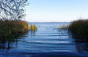 | ||
The Lake Arend is a natural lake in the Altmark region, northern Saxony-Anhalt, Germany. It is 23.3 m above sea level, and its area is 5.14 km², its depth nearly 50 m. It is the largest and deepest natural lake in Saxony-Anhalt.
Map of Arendsee, 39619 Arendsee, Germany
The lake lies on top of a salt dome and developed by repeated caving-in events that continued into historical time; at the end of the 19th century it was believed to have been created by an earthquake in 815. Hydrologically, the lake is more or less isolated with only a small artificial outflow connecting with the Elbe river via the river Jeetzel. The water body (0.147 bill. m³) only changes every 100 years. The town Arendsee and the municipality Schrampe are situated on its shores.
References
Arendsee (lake) Wikipedia(Text) CC BY-SA