
Intercommunality Val d'Ay Area 12.15 km² Local time Tuesday 6:11 PM | Canton Satillieu Time zone CET (UTC+1) Population 779 (1999) | |
 | ||
Weather 7°C, Wind SW at 8 km/h, 61% Humidity | ||
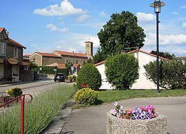
Ardoix (Ardoís in Occitan) is a French commune in the Ardèche department in the Auvergne-Rhône-Alpes region of southern France.
Contents
- Map of Ardoix France
- Geography
- History
- Administration
- Demography
- Distribution of Age Groups
- Sites and Monuments
- References
Map of Ardoix, France
The inhabitants of the commune are known as Ardoisiens or Ardoisiennes
Geography
Adoix is located some 7 km west by north-west of Saint-Vallier and 14 km south-east of Annonay. Access to the commune is by the D221 road from Sarras in the east passing through the length of the commune and the village and continuing south-west to Saint-Romain-d'Ay. Apart from the village there are the hamlets of Corme, Bruas, Thoue, and Chamas. The commune is a valley between two mountain ranges and apart from the slopes of the mountains is entirely farmland.
The Cance river forms a large part of the northern border of the commune as it flows east to the Rhone river. Many small tributaries of the Cance rise in the commune including the Ruisseau de la Goueille which forms the north-western border. The Ay river forms the southern border of the commune and also flows east to the Rhone.
History
In the gift of Quintenas made by Charlemagne to the Benedictine Abbey of Saint-Claude on 23 August 776, the Church of Saint-Didier d'Ardoix was mentioned. Also dependant on Saint Claude were the Chapel of Oriol, Saint-Alban-d'Ay, Saint-Jeure-d'Ay, Saint-Romain-d'Ay, and the chapel of Our Lady of Ay. In 1557 Ardoix, as was Quintenas, were secularized and thereafter administered by the Diocese of Vienne.
The old land of Ardoix had its chateaux and towers. Oriol, Munat, Manoha, Léorat, and le Pestrin Manoha was a fortified house and farm in medieval times. It is still a rural area today. The tower of Oriol is all that remains of the medieval castle which overlooked the gorges of the Ay. During the Hundred Years War it was sacked by soldiers. Taking advantage of the wars of religion, a criminal from Vernoux, Erard, took it and restored it to make it his lair. Farmers, frustrated by his robberies destroyed the castle to dislodge the bandit (who was hanged at Lamastre).
Administration
List of Successive Mayors
(Not all data is known)
Demography
In 2009 the commune had 1,050 inhabitants. The evolution of the number of inhabitants is known from the population censuses conducted in the commune since 1793. From the 21st century, a census of communes with fewer than 10,000 inhabitants is held every five years, unlike larger towns that have a sample survey every year.
Sources : Ldh/EHESS/Cassini until 1962, INSEE database from 1968 (population without double counting and municipal population from 2006)
Distribution of Age Groups
The population of the town is relatively young. The ratio of persons above the age of 60 years (15.9%) is lower than the national average (21.6%) and the departmental average (26.8%). Unlike national and departmental allocations, the male population of the town is greater than the female population (51.4% against 48.7% nationally and 49.1% at the departmental level).
Percentage Distribution of Age Groups in Ardoix and Ardèche Department in 2009
Sources: