
Country France Time zone CET (UTC+1) Area 233 ha Population 19,592 (2007) | Region Île-de-France INSEE/Postal code 94003 / Local time Tuesday 4:56 PM | |
 | ||
Weather 9°C, Wind W at 18 km/h, 55% Humidity Points of interest Musée d'arts graphiques, Ancienne brasserie Valstar, Ancienne maladrerie de la Banlieue | ||
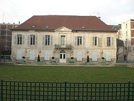
Arcueil [aʁkœj] is a commune in the Val-de-Marne department in the southern suburbs of Paris, France. It is located 5.3 km (3.3 mi) from the center of Paris.
Contents
- Map of Arcueil France
- Driving in france paris arcueil
- Name
- History
- Economy
- Transport
- Education
- Personalities
- References
Map of Arcueil, France
Driving in france paris arcueil
Name
The name Arcueil was recorded for the first time in 1119 as Arcoloï, and later in the 12th century as Arcoïalum, meaning "place of the arches" (Latin radical arcus, "arch", and Celtic suffix -ialo, "clearing, glade", "place of"), in reference to the Roman aqueduct carrying water to the Roman city of Lutetia (modern Paris). Still standing, the arches of the Roman aqueduct are still visible since the Middle Ages, crossing the Bièvre River valley near Arcueil.
History
The commune of Arcueil was officially renamed Arcueil-Cachan in 1894, after the hamlet of Cachan located within the commune. On 26 December 1922, Cachan seceded from the commune of Arcueil-Cachan and became a commune in its own right. The reduced commune of Arcueil-Cachan was renamed simply Arcueil.
Economy
Orange France, a subsidiary of France Télécom, has its headquarters in Arcueil.
Transport
Arcueil is served by two stations on Paris RER line B: Laplace and Arcueil – Cachan.
Education
Primary schools:
There is one junior high school, Collège Dulcie September.
Residents are served by the Lycée intercommunal Darius-Milhaud in Le Kremlin-Bicêtre.