
Area 12.99 km² | Canton La Javie Population (2009) 14 Local time Tuesday 10:27 AM | |
 | ||
Weather 6°C, Wind NE at 6 km/h, 94% Humidity | ||
Archail is a French commune in the Alpes-de-Haute-Provence department in the Provence-Alpes-Côte d'Azur region of south-eastern France.
Contents
- Map of 04420 Archail France
- Geography
- Geology
- Hydrology
- Natural and technological hazards
- Toponymy
- History
- Administration
- Demography
- Overview
- Agriculture
- Service activities
- Sites and Monuments
- Cultural life
- Notable People linked to the commune
- References
Map of 04420 Archail, France
It is the second least populated commune in the department.
The inhabitants of the commune are known as Archailois or Archailoises.
Geography
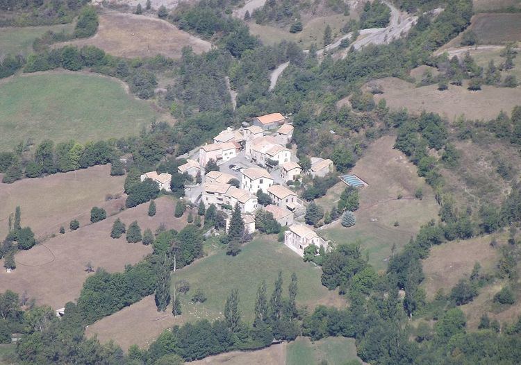
Archail is located some 8 km north-east of Digne and some 5 km south of Le Brusquet. By road from Digne it is 14 km by a winding mountain road. The village is located in a wooded basin at an altitude of 920m. Access to the commune is by the D22 road which runs east from Marcoux to Draix and which passes through the northern tip of the commune. A local road runs off the D22 in the northern tip of the commune and continues south through the commune to the village. The commune is mountainous and heavily forested but there is a small area of farmland south-west of the village.
Geology
Much of the commune consists of rounded hills of eroded black marl. The Pic de Couar (1,988m) is spectacular as is the Pas d'Archail (1,667m). The Ravine and Torrent of l'Areste is in the south in the hills.
Hydrology
A vast number of streams rise in the commune including: The Bouinenc (13.8 kilometres long), the Sauzeries Ravine (9 km long), the Mouiroués Ravine (8 km long), and its tributary, the Escure Stream (5.7 km long). These all flow north to join the Bouinenc which continues west to join the Bléone.
Natural and technological hazards
None of the 200 communes of the department is in a no seismic risk zone. The Canton of La Javie to which Archail belongs is in Zone 1b (low risk) according to the deterministic classification of 1991 and based on its seismic history. The Canton is in Zone 4 (medium risk) according to the probabilistic classification EC8 2011. The commune of Archail is also exposed to two other natural hazards:
Toponymy
The area appears for the first time in texts around 1200 in the form Archallo. The origin of the name is Celtic-Ligurian and means in front of the rocks. The Historical Atlas of Provence also indicates a spelling of Arcalhum.
History
In Antiquity the Bodiontiques (Bodiontici) inhabited the Bléone valley and so were the Gallic people who lived in what is now the commune of Archail. The Bodiontiques were defeated by Augustus at the same time as the other people present on the Tropaeum Alpium (before 14 BC) and were attached to the province of Alpes-Maritimes during its creation.
According to Daniel Thiery, the community was reported in the Polyptych of Wadalde (Bishop of Marseille) in 814 under the name Argario.
The community of Archail was under the Viguerie of Digne. In 1193 the lordship of Archail (Argal) was given by the two lords of Saint-Julien to the Chapter of Digne. The lordship was divided between the Bishops of Digne and the Chapter of Digne before the French Revolution. These new lords strengthened their new possession and collected the population in a central location.
As with many of the communes in the department, Archail had a school well before the Jules Ferry laws: in 1863 it already had a school that provided primary education for boys in the main town. No instruction was given to girls: neither the Falloux Laws (1851), which required the opening of a girls' school in communes with more than 800 inhabitants, nor the first Duruy Law (1867), which lowered the threshold to 500 inhabitants, related to Archail and it was only through the Ferry laws that Archail girls were able to regularly study.
Between 1973 and 1979 the commune was merged with Draix under the name Archail-Draix.
Administration
List of Successive Mayors
(Not all data is known)
Demography
In 1315 there were 25 fires in Archail. The censuses of 1471 and 1765 under the Ancien Régime reported 6 and 74 inhabitants respectively.
In 2009 the commune had 14 inhabitants. The evolution of the number of inhabitants is known from the population censuses conducted in the commune since 1793. From the 21st century, a census of communes with fewer than 10,000 inhabitants is held every five years, unlike larger towns that have a sample survey every year.
Sources : Ldh/EHESS/Cassini until 1962, INSEE database from 1968 (population without double counting and municipal population from 2006)
The demographic history of Archail after the bloodletting of the 14th and 15th centuries was of a long growth trend until the beginning of the 19th century and was marked by a period of "stretches" where the population remained stable and relatively high. This period was particularly long in Archail - from 1821 to 1891. Although the rural exodus began late in Archail, it was nonetheless a longstanding trend and quick. After thirty years of hindsight and the First World War, the town recorded the loss of half of its population from the historic maximum of 1856-1861. The decline continued until the 21st century when the population of Archail increased between 2005 and 2010 - the first time in a century.
Overview
In 2009, the active population was 7 people with no unemployed. 6 out of 7 of these workers are employees and work outside the commune.
As at 1 January 2011 the commune had only four active establishments: one in the construction sector, and three in the services sector, which offered the only job in the commune.
Agriculture
At the end of 2010 there was no commercial operation in the primary sector (agriculture, forestry, fisheries). There are nevertheless artificial meadows irrigated from the irrigation reservoir above the village at the foot of the Pic du Couar which was dug in the 1980s under the leadership of the Mayor [ref. needed] and the sheep farmer.
Service activities
At the end of 2010 the tertiary sector (trade, service) consisted of 3 establishments with 1 job.
According to the Departmental Observatory of Tourism, tourism is very important for the community, with more than 5 tourists welcomed per resident. Most of the accommodation capacity is non-market and is composed solely of secondary homes: 18 secondary homes are three quarters of the commune housing.
Sites and Monuments
Cultural life
The association Les Ateliers du Couar hosts May Art every year in May with many artists-exhibitors (ceramics, paintings, sculptors, photographers) and various other events related to images in all their forms and in association with many artistic expressions (literature, poetry, cinema, theatre etc.). The theme is rural and historical heritage and messages are conveyed through various modes such as the creation of an Artist's book on transhumance.
This association publishes Les Cahiers du Couar with four numbers: