
River mouth Étang de Berre Length 83 km Source elevation 470 m Mouth Étang de Berre | Basin size 727 km (281 sq mi) Basin area 727 km² | |
 | ||
Main source near Pourcieux470 m (1,540 ft) | ||
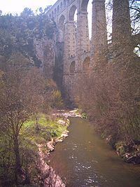
The Arc is an 83-kilometre (52 mi) long river in the south of France. It arises at an elevation of 470 metres (1,540 ft), close to the village of Pourcieux. It then passes through Aix-en-Provence before flowing into the Étang de Berre, a lagoon connected with the Mediterranean Sea to the west of Marseille. Its drainage basin, with a surface area of 727 square kilometres (281 sq mi), is divided between two départments, Var and Bouches-du-Rhône. The Bayeux, the Cause and the Torse are its tributaries.
Map of L'Arc, Berre-l'%C3%89tang, France
References
Arc (Provence) Wikipedia(Text) CC BY-SA