
Department Ain Intercommunality Bugey Sud Area 13.07 km² | Population (2009) 471 Local time Tuesday 7:27 AM | |
 | ||
Weather 8°C, Wind SW at 14 km/h, 79% Humidity | ||
Ush trec arbignieu 2014 2 3
Arbignieu is a former commune in the Ain department in the Auvergne-Rhône-Alpes region of eastern France. On 1 January 2016, it was merged into the new commune Arboys-en-Bugey.
Contents
- Ush trec arbignieu 2014 2 3
- Map of 01300 Arbignieu France
- Trec amical d arbignieu
- Geography
- Administration
- Demography
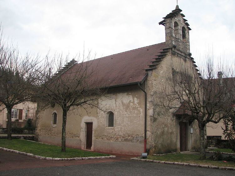
- Sites and monuments
- Notable people linked to the commune
- References
Map of 01300 Arbignieu, France
The inhabitants of the commune are known as Arbignolans or Arbignolanes
Trec amical d arbignieu
Geography
The commune is located 4 km south-west of Belley and 30 km north-west of Chambery. It is traversed by the Tour du Bugey trail. It lies in the Appellation d'origine contrôlée (AOC) zone for wine from Bugey with the label "Roussette du Bugey-Arbignieu".
The commune can be accessed on the D69 from Belley in the north-east which continues west to Colomieu. The D100 road also branches from the D49 at the northern edge of the commune and goes south along the eastern side of the commune joining the D10 which passes through the commune from the D992 in the east through the hamlet of Peyzieu then south-west to Saint-Bois. There are three hamlets in the commune other than Arbignieu: Thoys, Slignieu, and Peyzieu. The commune is approximately half farmland and half forest with most of the forest along the western border.
The Furans river forms the eastern border of the commune and then flows east to join the Rhone. The Ruisseau d'Armaille flows from west to east across the commune into the Furans.
Administration
List of mayors of Arbignieu
(Not all data is known)
Demography
In 2010 the commune had 480 inhabitants. The evolution of the number of inhabitants is known through the population censuses conducted in the town since 1793. From the 21st century, a census of municipalities with fewer than 10,000 inhabitants is held every five years, unlike larger towns that have a sample survey every year.
Sources : Ldh/EHESS/Cassini until 1962, INSEE database from 1968 (population without double counting and municipal population from 2006)