
District Neelam Elevation 2,554 m | Time zone PST | |
 | ||
Weather -1°C, Wind E at 6 km/h, 71% Humidity | ||
From Wikipedia, the free encyclopedia
Contents
- Map of Arang Kel
- Arang kel neelum valley ajk pakistan
- Accessibility
- Accommodation and guest houses
- References
Map of Arang Kel
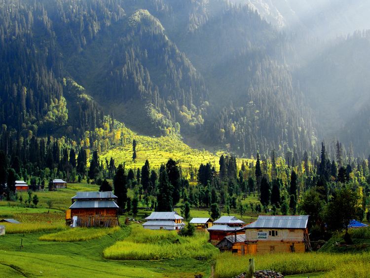
Arang Kel is a lush green village, hill station and tourist spot in Neelam valley, Azad Kashmir, Pakistan. It is located on the hill top above Kel at the altitude of 8,379 feet (2,554 m) feet.
Arang kel neelum valley ajk pakistan
Accessibility
The village is accessible by a 2 kilometers (1.2 mi) trek from Kel. To reach Kel people usually enter into the Neelam valley from Muzafarabad. Roads are only good from Muzafarabad up to Athmuqam and one can use public van service to reach there. After passing Athmuqam, one has to use a personal or rented vehicle to pass through Keran, Kutton, Dawarrian and Sharda and then to reach Kel. Kel is located just 19 kilometers (12 mi) ahead from Sharda at the altitude of 6,879 feet (2,097 m).
Accommodation and guest houses
Beautiful guest houses can be easily found in the range of Rs1000-Rs2000 ($10-$20) per person. Food is not going to cheap either as locals have to use donkeys and horses to take food items from Kel to Arang Kel.