
Length 2,627 km Basin area 358,125 km² | Discharge 6,172 m³/s Source elevation 760 m | |
 | ||
- average 6,172 m/s (217,962 cu ft/s) | ||
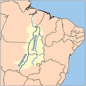
The Araguaia River (Portuguese: Rio Araguaia [ˈʁi.u ɐɾɐˈɡwaj.jɐ]) is one of the major rivers of Brazil, and the principal tributary of the Tocantins, though it is almost equal in volume at its confluence with the Tocantins. It has a total length of approximately 2,627 km. Araguaia means "river of (red) macaws" in the Tupi language.
Contents
- Por do sol no rio araguaia sunset in the araguaia river
- Geography
- Tributaries
- History
- Towns
- Tourism
- References
Por do sol no rio araguaia sunset in the araguaia river
Geography
Because of the vast number of tributaries, it is not easy to define its source. Important tributaries originate in the Araras mountain range in Mato Grosso as well in the Divisões mountain range situated in Goiás (according to other sources however, the Araguaia comes from the Caiapó Range, at the Goiás-Mato Grosso border). From there it flows northeast to a junction with the Tocantins near the town of São João.
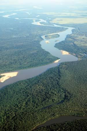
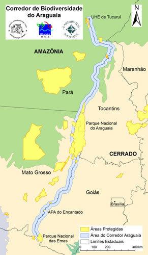
Along its course, the river forms the border between the Brazilian federal states of Goiás, Mato Grosso, Tocantins and Pará. Roughly in the middle of its course, the Araguaia splits into two forks (with the western one retaining the name Araguaia and the eastern one being called the Javaés River). These later reunite, forming the Ilha do Bananal, the world's largest river island. The mouth of the Javaés forms a broad inland delta where it pours back into the main Araguaia, a 100,000 hectare expanse of igapó flooded forest, blackwater river channels, and oxbow lakes called Cantão, protected by the Cantão State Park. This is one of the biologically richest areas of the eastern Amazon, with over 700 species of birds, nearly 300 species of fish, large populations of threatened species such as the giant otter, the black cayman, the world's largest freshwater fish, the pirarucú, and the endemic Araguaian river dolphin (or Araguaian boto) all occurring within a relatively small area.
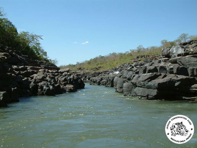
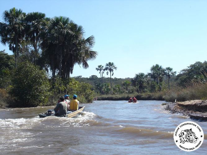
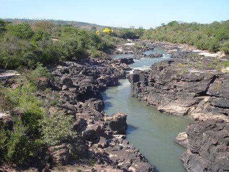
A large portion of the Araguaia's course is navigable all year, but the river below the Cantão wetlands is interrupted by rapids.
The combined watershed of Araguaia and Tocantins rivers (named the Araguaia Tocantins Basin) covers approximately 9.5% of Brazil's national territory. This area is an integral part of the Amazon Basin. However, the Araguaia River is not a tributary of the Amazon.
"Araguaia" means "River of the Macaws" in the native Tupi language.
Tributaries
Its principal tributary is the Rio das Mortes, which rises in the Serra de São Jerônimo, near Cuiabá, Mato Grosso, and is navigable to Pará.
Other important tributaries include the Bonito, Garcas, Tapirape and the Formoso or Cristalino on the west, and the Pitombas, Claro, Vermelho, Tucupa and Chavante on the east.
History
It was explored in part by Henri Coudreau in 1897. From 1972 to 1974 this region was the scene of a conflict between left-wing guerrilla movements and forces supporting the then military dictatorship.
Towns
Among the most important settlements on the banks of the Araguaia River are (in a downstream order):
Tourism
Several parts of the river's course are protected by national parks and other reserves like the Emas National Park and the Araguaia National Park. The Araguaia has "beaches" - bright sandy banks that seam the stream from May to October.