
Department Ain Intercommunality Haut Bugey Area 14.57 km² | Population (2009) 352 Local time Monday 8:41 PM | |
 | ||
Weather 9°C, Wind S at 35 km/h, 62% Humidity | ||
Apremont is a French commune in the department of Ain in the Auvergne-Rhône-Alpes region of eastern France.
Contents
Map of 01100 Apremont, France
The inhabitants of the commune are known as Marranes
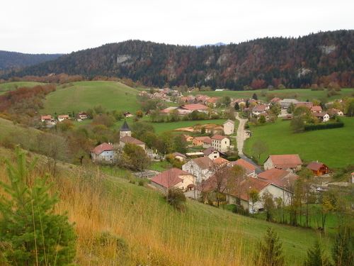
Geography
Apremont is located halfway between Nantua and Oyonnax some 20 km north-west of Bellegarde-sur-Valserine and 40 km east of Bourg-en-Bresse. The commune has an area of 1456 hectares and is bounded by the communes of Bellignat, Oyonnax, Charix, Nantua, Montreal-la-Cluse, Martignat, and Groissiat. The commune is composed of several villages including:
There are also a few isolated farms such as Les Éterres, le Cree, and Molet.
The commune can be accessed by road D74 from Oyonnax in the north passing though the heart of the commune and the village and continuing to Nantua in the south. There is also access via the D95 from Charix in the south-west to the town. There are also several small roads in the commune. The commune consists of forest and mountain landscape.
The Lange river rises in the town and flows north to Oyonnax before turning south and joining the Oignin at Le Mollard.
Administration
List of Successive Mayors of Apremont
(Not all data is known)
Demography
In 2009 the commune had 352 inhabitants. The evolution of the number of inhabitants is known through the population censuses conducted in the town since 1793. From the 21st century, a census of municipalities with fewer than 10,000 inhabitants is held every five years, unlike larger towns that have a sample survey every year.
Sources : Ldh/EHESS/Cassini until 1962, INSEE database from 1968 (population without double counting and municipal population from 2006)