
Country France Department Ariège Canton Cabannes | Region Occitanie Arrondissement Foix Intercommunality Vallées d'Ax | |
 | ||
Appy is a French commune in the Ariège department in the Occitanie region of southwestern France.
Contents
The inhabitants of the commune are known as Pynarols or Pynaroles
Geography
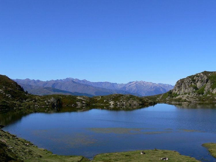
Appy is located some 15 km south-east of Tarascon-sur-Ariège and 12 km north-west of Ax-les-Thermes. Access is by the D20 road from Axiat in the east passing through the village and continuing to Caychax in the west. Appy is a remote mountainous commune, heavily forested in the south and west, with the rest alpine terrain.
In the north of the commune is the Etang d'Appy from which flows the Ruisseau de Lac d'Appy towards the south-west to join the Ruisseau de Caychax which joins the Ariège at Albiès. The eastern boundary of the commune is formed by the Ruisseau de Girabel which flows south joining with other streams to join the Ariege at Urs. The Ruisseau de Camelong rises north of the village and flows south-east to join the Ruisseau de la Cassagne.
Administration
List of Successive Mayors
(Not all data is known)
Demography
The village became almost uninhabited, so much so that there was a period of 64 years without a marriage: there was a marriage in 1946 then one in 2010 which was the subject of an article in La Dépêche du Midi.
In 2009 the commune had 27 inhabitants. The evolution of the number of inhabitants is known from the population censuses conducted in the commune since 1793. From the 21st century, a census of communes with fewer than 10,000 inhabitants is held every five years, unlike larger towns that have a sample survey every year.
Sources : Ldh/EHESS/Cassini until 1962, INSEE database from 1968 (population without double counting and municipal population from 2006)