
Time zone IST (UTC+5:30) Literacy 93.4% ISO 3166 code ISO 3166-2:IN | Area 28.44 km² Population 36,290 (2011) | |
 | ||
PIN 670331, 670562, 670563, 670564, 670567. | ||
Anthoor municipality kannur ldf won 28 28
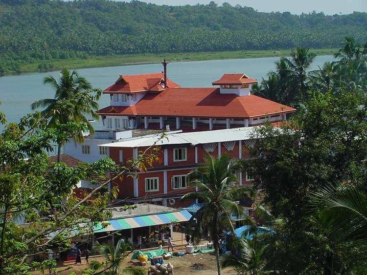
Anthoor (Malayalam: ആന്തൂർ നഗരസഭ) is a Municipality in the Kannur district of North Malabar region in the Indian state of Kerala. Anthoor is located around 14 km from Kannur Corporation and it is adjacent with Taliparamba Municipality.
Contents
- Anthoor municipality kannur ldf won 28 28
- K sudhakaran speaks against cpm in anthoor municipality kerala local body election
- Demographics
- Etymology
- History
- Culture and geography
- Famous Institutions in Anthoor
- Administration
- Educational organizations
- Major industries
- Politics
- Transportation
- Municipal Wards
- References
K sudhakaran speaks against cpm in anthoor municipality kerala local body election
Demographics
As of 2011 India Census, Anthoor had a population of 36290, with 17,154 males and 19,136 females.
Anthoor was a Panchayath consisting of two tiny villages viz. Morazha and Anthoor. In 1990, when Govt of Kerala announced new Municipalities, Anthoor Panchayat was merged with Taliparamba to form a new Municipality of Taliparamba. Later in 2015 the Govt separated Anthoor from Taliparamba and made it an independent Municipality. Anthoor is a Municipality by its population and density but remain with the characteristics of a beautiful village. Its tucked on NH-17, situated near Taliparamba in Kannur District of North Malabar region in Kerala.
Etymology
The name Anthoor means large village. Due to its large size, it was split into two i.e. Anthoor and Morazha. The hill of Anthoor has been mentioned in many Theyyam folk songs/Thottam Pattu (തോറ്റം പാട്ട്).
History
During Kolathiri rule, Anthoor was under them. Later, Tipu Sultan adjoined this area as part of Kingdom of Mysore. During British Raj this place was under Chirakkal Taluk of Malabar District in Madras Presidency. After formation of Kerala State this area was made as a Panchayat in Cannanore District. Later the Anthoor Panchayat was merged with Taliparambu Municipality upon later's formation. Presently Anthoor is an independent Municipality of Kannur District of Kerala State.
The Anthoor Municipality has formulated as per the Go(Rt) no 148/2015 LSGD order dated 30/04/2015 .
Culture and geography
Famous Institutions in Anthoor
The popular Institutions as well as significant Areas of Anthoor Municipality (ആന്തൂർ നഗരസഭ) are:
Administration
Educational organizations
Major industries
The major industries are:
Politics
Anthoor is always 100% CPIM Supporting Area. Many of the Councillors are elected unopposed.
Transportation
The national highway passes through Dharmashala junction. Mangalore and Mumbai can be accessed on the northern side and Cochin and Thiruvananthapuram can be accessed on the southern side. The road to the east connects to Mysore and Bangalore. The nearest railway stations are Kannapuram and Kannur on Mangalore-Palakkad line. There are airports at Mangalore and Calicut.