
Vehicle registration EM Regional unit Syros | Time zone EET (UTC+2) Local time Sunday 4:27 AM | |
 | ||
Weather 14°C, Wind E at 10 km/h, 81% Humidity | ||
Syros greece ano syros atlasvisual
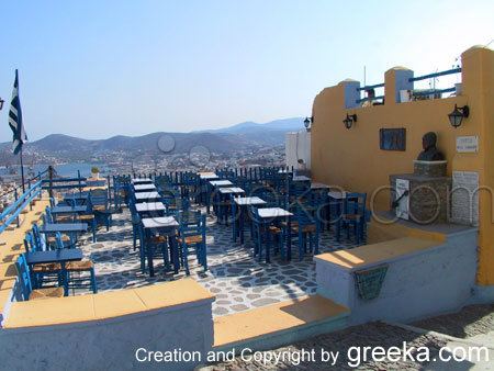
Ano Syros (Greek: Άνω Σύρος, “Upper Syros”) is a town and a former municipality on the island of Syros, in the Cyclades, Greece. Since the 2011 local government reform it is part of the municipality Syros-Ermoupoli, of which it is a municipal unit. The municipal unit includes the uninhabited islands Gyaros (lying to the northwest of Syros) and Varvaroúsa. Population 3,877 (2011 census); land area 67.014 square kilometres (25.874 square miles). The municipal unit shares the island of Sýros with the municipal units of Ermoupoli and Poseidonia.
Contents
- Syros greece ano syros atlasvisual
- Map of Ano Syros 841 00 Greece
- Ano syros aerial video drone fpv
- History
- Places of interest
- Twin towns Sister cities
- People
- References
Map of Ano Syros 841 00, Greece
Ano syros aerial video drone fpv
History
Ano Syros is the medieval settlement of Syros. It is built during later Byzantine era or early Frankokratia. It is a classical cycladic medieval settlement that is densely built with narrow roads, circular order and a radial street plan. The overall effect reminds a fortified citadel. Ano Syros is inhabited by Catholic Greeks. The reason for it is the long period of Frankokratia in Syros that started immediately after the fourth crusade. Frankokratia ended during 16th century but the Catholics of Syros came under France protection and the catholic religion survived in the island. After founding of nearby Hermoupolis, Ano Syros ceased to be the administrative centre of Syros. Nevertheless, the settlement remained a religious centre since it is the seat of Roman Catholic Diocese of Syros and Milos.
Places of interest
Twin towns — Sister cities
Ano Syros is twinned with: