
Country India Region Coastal Andhra Time zone IST (UTC+5:30) Local time Sunday 5:13 AM | District East Godavari Population 6,865 (2011) Area code 08868 | |
 | ||
PIN 533406 [Annavaram Shankavaram(mandal) at East Godavari District] Weather 22°C, Wind NW at 0 km/h, 97% Humidity Neighborhoods Satya Deva Colony, Annavaram Colony, Velampeta | ||
Annavaram temple and beach andhra pradesh india hd video
Annavaram is a village situated on the banks of the pampa river in the East Godavari district of the Indian state of Andhra Pradesh.
Contents
- Annavaram temple and beach andhra pradesh india hd video
- Map of Annavaram Andhra Pradesh
- Etymology
- Temples
- Transport
- References
Map of Annavaram, Andhra Pradesh
Annavaram temple and beach andhra pradesh india hd video
Etymology
Anna translates to "what you desire", while "varam" means boon or godsend. Hence, the name Annavaram is an expression of the belief that the deity will endow one with whatever one desires.
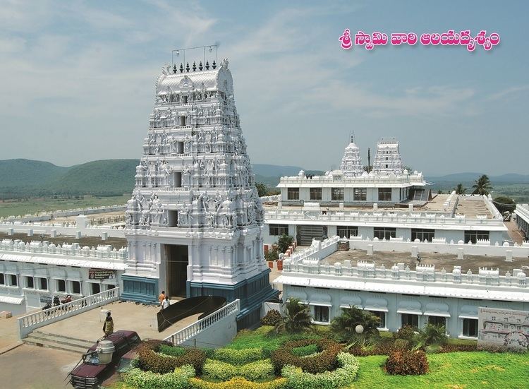
Temples
The most distinctive feature of Annavaram is the shrine to Lord Veera Venkata Satyanarayana Swamy situated upon the Ratnagiri Hills. The land is considered to belong to both Lord Sri Veera Venkata Satyanarayana Swami Temple and Goddess Anantalaxmi Satyavathi Ammavaru.
Transport
National Highway 5 passes through Annavaram. The Andhra Pradesh State Road Transport Corporation operates bus services from Annavaram bus station. Annavaram railway station is located at the main Howrah-Chennai main line. It is classified as a B–category station in the Vijayawada railway division of South Central Railway zone.