
Country United States County Polk Time zone CST (UTC-6) Elevation 277 m Population 51,567 (2013) | Incorporated February 28, 1903 ZIP codes 50015, 50021, 50023 Local time Saturday 1:00 PM | |
 | ||
Weather -3°C, Wind W at 14 km/h, 61% Humidity Colleges and Universities Des Moines Area Community College, Faith Baptist Bible College and Theological Seminary | ||
Ankeny iowa is bringing it all together
Ankeny is a city in Polk County, Iowa, United States. The population was 45,562 in the 2010 census, an increase of 68% from the 27,117 population in the 2000 census. It is part of the Des Moines–West Des Moines Metropolitan Statistical Area. It is one of the most affluent cities in all of Iowa.
Contents
- Ankeny iowa is bringing it all together
- Map of Ankeny IA USA
- Holiday inn express suites ankeny des moines ankeny iowa
- History
- Geography
- Demographics
- 2010 census
- 2000 census
- Economy
- Education
- Notable people
- Tourism
- References
Map of Ankeny, IA, USA
Holiday inn express suites ankeny des moines ankeny iowa
History
Ankeny was founded by John and Sarah Ankeny in 1875 and was incorporated on February 28, 1903. A railroad link from Des Moines through Ankeny to Ames was completed in 1874 and passenger service established in 1880.
Coal mining became an important activity in the Ankeny area in the early 20th century. The Anderson Coal Company sank a shaft 2 miles (3 km) southeast of Ankeny in 1908. Enterprise, 4 miles (6 km) east of Ankeny, was the company town of the Enterprise Coal Company, with two large mines opened in 1903 and 1907. In 1914, the Enterprise Coal Company produced over 100,000 tons of coal, ranking among the top 24 coal producers in the state. In 1912, United Mine Workers Local 2476 in Ankeny had 246 members, over half of the total population at the time, and Local 2511 in Enterprise had 395 members.
Ankeny started off as just one square mile, and just 445 people. Electricity was first introduced in 1907. Ankeny's first fire department was established in 1907 and was volunteer-based. They had only three ladders and 14 water pails when the department started.
During World War II Ankeny was home to a federal ordnance plant that manufactured ammunition. After the war, Deere & Company purchased the plant for its Des Moines Works, while Iowa State University used the remainder of the land for its research farm. In June 2005 ISU sold the land to the city of Ankeny, which plans to develop it into a mixed-use development known as "Prairie Trail."
Geography
Ankeny is located at 41°43′36″N 93°36′15″W (41.726788, −93.604283). It is along Interstate 35 and U.S. Route 69 about 7 miles (11 km) north of downtown Des Moines.
According to the United States Census Bureau, the city has a total area of 29.33 square miles (75.96 km2), all of it land.
Demographics
In 1940 Ankeny had a population of 779, but its population began to grow with the rest of the Des Moines suburbs after World War II. The 2010 census of 45,582 makes Ankeny the third-largest city in Polk County, behind Des Moines and West Des Moines. The City of Ankeny reached a population of over 50,000 in 2014.
2010 census
As of the census of 2010, there were 45,582 people, 17,433 households, and 12,087 families residing in the city. The population density was 1,554.1 inhabitants per square mile (600.0/km2). There were 18,339 housing units at an average density of 625.3 per square mile (241.4/km2). The racial makeup of the city was 94.7% White, 1.2% African American, 0.1% Native American, 2.0% Asian, 0.1% Pacific Islander, 0.6% from other races, and 1.3% from two or more races. Hispanic or Latino of any race were 2.3% of the population.
There were 17,433 households of which 38.4% had children under the age of 18 living with them, 58.9% were married couples living together, 7.2% had a female householder with no husband present, 3.2% had a male householder with no wife present, and 30.7% were non-families. 22.6% of all households were made up of individuals and 6.2% had someone living alone who was 65 years of age or older. The average household size was 2.58 and the average family size was 3.08.
The median age in the city was 31.9 years. 27.7% of residents were under the age of 18; 9.1% were between the ages of 18 and 24; 33.7% were from 25 to 44; 21.1% were from 45 to 64; and 8.3% were 65 years of age or older. The gender makeup of the city was 49.0% male and 51.0% female.
It is one of the most affluent cities in the state of Iowa, with a GDP per capita of $48,143 (the average Iowa GPD per capita being $25,335).
2000 census
As of the census of 2000, there were 27,117 people, 10,339 households, and 7,278 families residing in the city. The population density was 1,616.5 people per square mile (624.3/km²). There were 10,882 housing units at an average density of 648.7 per square mile (250.5/km²). The racial makeup of the city was 96.94% White, 0.76% African American, 0.15% Native American, 0.94% Asian, 0.03% Pacific Islander, 0.38% from other races, and 0.81% from two or more races. Hispanic or Latino of any race were 1.08% of the population.
There were 10,339 households out of which 38.1% had children under the age of 18 living with them, 60.7% were married couples living together, 7.3% had a female householder with no husband present, and 29.6% were non-families. 21.8% of all households were made up of individuals and 5.8% had someone living alone who was 65 years of age or older. The average household size was 2.57 and the average family size was 3.05.
Age spread: 27.1% under the age of 18, 11.4% from 18 to 24, 33.4% from 25 to 44, 20.1% from 45 to 64, and 8.0% who were 65 years of age or older. The median age was 32 years. For every 100 females there were 94.0 males. For every 100 females age 18 and over, there were 91.4 males.
In 2008, the median income for a household in the city was $70,197, and the median income for a family was $88,231. Males had a median income of $54,532 versus $41,507 for females. The per capita income for the city was $31,527. About 1.6% of families and 2.8% of the population are below the poverty line, including 2.5% of those under age 18 and 5.0% of those age 65 or over.
Economy
Major employers in Ankeny include the Ankeny Community School District, Des Moines Area Community College, Deere & Company's Des Moines Works, Perishable Distributors of Iowa (a Hy-Vee subsidiary), Tone's Spices, Casey's General Stores, the City of Ankeny, Sysco Food Services of Iowa, Praxair, and Mrs. Clark's Foods.
Over the past two decades, commercial expansion has been significant throughout much of the growing city.
On the city's eastern edge running parallel to Interstate 35, Delaware Avenue was one of the first major roadways to receive commercial development. As of late 2016, it boasts large box stores such as a Wal-Mart SuperCenter, SuperTarget, Home Depot, Kohl's, Menards, Staples, Sportsman's Warehouse, Mills Fleet Farm, Sam's Club, and Best Buy, many medium-sized specialty stores, such as Michael's, Jo Ann Fabric and Crafts, Petsmart, and TJ Maxx, and plentiful smaller businesses ranging from restaurants and boutiques to cell phone retailers and salons. South of Oralabor Road, there are many large car dealerships, such as Karl Chevrolet, Bob Brown Pontiac-GMC-Buick, Dewey Ford, and Dewey Dodge-Jeep.
In December 2008 the city received attention from news organizations across the United States when it was revealed that Tone's Spices had donated 18,000 lbs of expired garlic salt for use in melting ice and snow on its roadways.
In 2008, Ankeny was recognized as one of the top ten towns for families by Family Circle. In 2009, Ankeny was ranked No. 62 in MONEY Magazine's top 100 places to live list. In 2015, it was designated a Playful City USA by the KaBoom! Foundation for the ninth consecutive year.
Education
The post-secondary institutions are the primary Des Moines Area Community College (DMACC) campus and Faith Baptist Bible College and Theological Seminary. Simpson College and Upper Iowa University also operate extension facilities there.
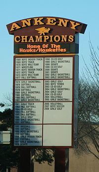
The Ankeny Community School District consists of ten elementary schools, four middle schools, and two high schools.
The Ankeny Community School District is located in Polk County, Iowa, in the heart of the State of Iowa. Six miles from the capitol city of Des Moines, the district:
Ankeny Christian Academy is a private Preschool-12th grade school. ACA is a non-denominational Christian school and is accredited by the State of Iowa.
In December 2010, the Diocese of Des Moines announced a new parish to be built that will include a school on the western side of the community on NW Weigel Drive, just north of West 5th St. Initial plans are for the school to house grades K-8 and will open in fall 2015.