
Founded 1846 Largest city Des Moines Time zone Central: UTC-6/-5 Area 1,533 km² County seat Des Moines | Named for James K. Polk Congressional district 3rd Website www.polkcountyiowa.gov Population 451,677 (2013) Unemployment rate 3.6% (Apr 2015) | |
 | ||
Rivers Des Moines River, Raccoon River, Walnut Creek Destinations Des Moines, West Des Moines, Ankeny, Altoona, Johnston Colleges and Universities Drake University, Des Moines Area Co, Drake University Law Scho, Grand View University, Des Moines University | ||
Polk County is a county in the U.S. state of Iowa. As of the 2010 census, the population was 430,640, making it Iowa's most populous county. The county seat is Des Moines, which is also the capital city of Iowa.
Contents
- Map of Polk County IA USA
- Polk county and des moines iowa police chase
- History
- Geography
- Adjacent counties
- 2010 census
- 2000 census
- Government and Infrastructure
- Census designated place
- Unincorporated communities
- Population ranking
- References
Map of Polk County, IA, USA
Polk County is included the Des Moines–West Des Moines, IA Metropolitan Statistical Area.
Polk county and des moines iowa police chase
History
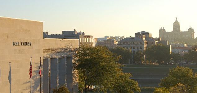
Polk County was formed on January 13, 1846. It was named after President James K. Polk.
The first courthouse, a two-story structure, was built in 1846. Construction of a second courthouse was begun in 1858. Due to construction delays and the onset of the Civil War, the structure was not completed until 1866. The present courthouse was erected in 1906 in the Beaux Arts style. It was dedicated on October 31, 1906. In 1962, an extensive renovation was undertaken.
Geography
According to the U.S. Census Bureau, the county has a total area of 592 square miles (1,530 km2), of which 574 square miles (1,490 km2) is land and 18 square miles (47 km2) (3.0%) is water. The county is bisected by the Des Moines River.
Adjacent counties
2010 census
The 2010 census recorded a population of 430,640 in the county, with a population density of 756.371/sq mi (292.037/km2). There were 182,262 housing units, of which 170,197 were occupied.
2000 census
As of the census of 2000, there were 374,601 people, 149,112 households, and 96,624 families residing in the county. The population density was 658 people per square mile (254/km²). There were 156,447 housing units at an average density of 275 per square mile (106/km²). The racial makeup of the county was 88.34% White, 4.84% Black or African American, 0.27% Native American, 2.63% Asian, 0.06% Pacific Islander, 2.22% from other races, and 1.66% from two or more races. 4.40% of the population were Hispanic or Latino of any race. 25.9% were of German, 10.6% Irish, 9.0% English and 8.4% American ancestry according to Census 2000.
There were 149,112 households out of which 32.20% had children under the age of 18 living with them, 51.00% were married couples living together, 10.30% had a female householder with no husband present, and 35.20% were non-families. 28.10% of all households were made up of individuals and 8.60% had someone living alone who was 65 years of age or older. The average household size was 2.45 and the average family size was 3.04.
Age spread: 25.70% under the age of 18, 9.40% from 18 to 24, 32.20% from 25 to 44, 21.50% from 45 to 64, and 11.10% who were 65 years of age or older. The median age was 34 years. For every 100 females there were 94.20 males. For every 100 females age 18 and over, there were 90.70 males.
The median income for a household in the county was $46,116, and the median income for a family was $56,560. Males had a median income of $37,182 versus $28,000 for females. The per capita income for the county was $23,654. About 5.30% of families and 7.90% of the population were below the poverty line, including 9.70% of those under age 18 and 6.40% of those age 65 or over.
Government and Infrastructure
The Iowa Department of Corrections Iowa Correctional Institution for Women is located in Mitchellville and in Polk County.
Census-designated place
Unincorporated communities
Population ranking
The population ranking of the following table is based on the 2010 census of Polk County.
† county seat