
 | ||
Ciudad de m xico anillo perif rico segundo piso supervia carretera
The Anillo Periférico (Spanish for peripheral ring) is the outer beltway of Mexico City.
Contents
- Ciudad de m xico anillo perif rico segundo piso supervia carretera
- Map of Anillo Periferico Mexicali BC Mexico
- Tegucigalpa anillo perif rico
- References
Map of Anillo Periferico, Mexicali, B.C., Mexico
The Periferico was originally planned by architect Carlos Contreras as early as 1925, together with other major roads such as the Viaducto Miguel Alemán. Some parts of the beltway were built to follow the bed of a river; the flow of the river was modified to flow through a pipe.
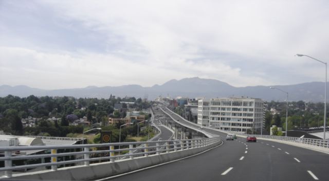
The beltway gained major media attention when the Mexico City mayor, Andrés Manuel López Obrador, started a project to turn a southern section of the ring into a two-story highway. The second level was finished in 2006 in the Federal District and in the State of Mexico in 2009. From Cuautitlán in the north (State of Mexico) to Naucalpan at the Federal District border the second floor operates as the Viaducto Elevado Bicentenario ("Bicentennial Elevated Viaduct"). From the old bullring (Toreo) at the north of the Federal District to San Jerónimo in the southwest the second level is called the Autopista Urbana Norte ("Northern Urban Tollway"). At San Jerónimo the second level intersects directly with a toll road to Santa Fe, the Supervía Poniente. From San Jerónimo to the intersection with the Calzada de Tlalpan in the south of the city, the second level is called the Autopista Urbana Sur ("Southern Urban Tollway").