
Population 1,865 (2006 census) Postcode(s) 5353 Founded 1842 Local time Friday 9:38 AM | Established 1842 LGA(s) Barossa Council Elevation 347 m Postal code 5353 | |
 | ||
Weather 22°C, Wind E at 13 km/h, 52% Humidity | ||
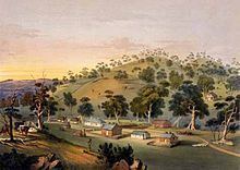
Angaston is a town on the eastern side of the Barossa Valley in South Australia, 77 km northeast of Adelaide. Its elevation is 347 m, one of the highest points in the valley, and has an average rainfall of 561 mm. Angaston was originally known as German Pass, but later was named after George Fife Angas, who settled in the area in the 1850s. Angaston is in the Barossa Council local government area, the state electoral district of Schubert and the federal Division of Barker.
Contents
- Map of Angaston SA 5353 Australia
- Railway
- Notable former residents
- Wineries
- Other places
- Tour Down Under
- References
Map of Angaston SA 5353, Australia
Railway
Angaston was the terminus of the Barossa Valley railway line which was built in 1911. The railway has now closed and been replaced by a bike path from Nuriootpa.
Notable former residents
Wineries
Other places
Tour Down Under
The finish of the 135 km, first stage of the 2014 Tour Down Under occurred on 21 January 2014 within the town. The race started in Nuriootpa and was won by Simon Gerrans of Orica-GreenEDGE.