
FIPS code 19-02125 Elevation 269 m Zip code 52030 Local time Thursday 5:14 AM | Time zone Central (CST) (UTC-6) GNIS feature ID 0454187 Area 70 ha Population 424 (2013) Area code 563 | |
 | ||
Weather -4°C, Wind W at 18 km/h, 79% Humidity | ||
Andrew is a city in Jackson County, Iowa, United States. The population was 434 at the 2010 census.
Contents
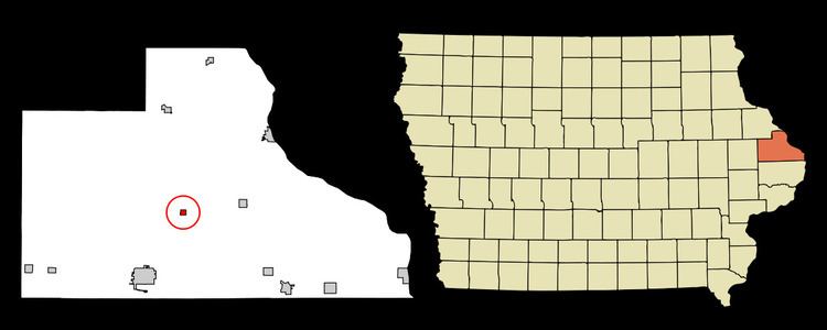
- Map of Andrew IA 52060 USA
- History
- City Parks and Recreation
- Geography
- 2012 Census
- 2010 census
- 2000 census
- Education
- Notable people
- References
Map of Andrew, IA 52060, USA
History
Andrew, located in Jackson County, was named for the seventh president, Andrew Jackson.
In 1841 Ansel Briggs, the first governor of Iowa, settled on a location outside of Andrew known as Bluff Mills, later moving his family to town. He became the Jackson County deputy treasurer in 1843 then began a two-year term as Sheriff of Jackson County in 1844. Ansel Briggs won the election against Thomas McKnight for the governor of Iowa in 1846. Briggs served as governor until 1850. On September 22, 1909 the citizens of Andrew erected a granite monument in the city cemetery in his honor. Although Briggs was originally buried in Omaha, Nebraska he was re-interred in 1909 in the Andrew Cemetery.
Andrew was incorporated in 1863 with the first record of ordinances recorded in 1867. The county seat switched between Bellevue and Andrew several times until it was moved to Maquoketa in 1873. The county seat was responsible for much of the growth of the city. An orphans asylum and courthouse was built along with other structures to serve the county government.
The Jackson County Jailhouse was built in 1870 and is now listed on the National Register of Historic Places. The three-story limestone structure includes sheriff's office, cell room, exercise yard, a jailer quarters, and prison kitchen. The jailhouse has since been restored and tours are given.
The first school was made of logs in 1841 and the second was a framed structure. A brick building was built in 1889 where the present school is, 13 South Marion Street. Andrew Community School conducts preschool through high school level classes.
Andrew is the birthplace of the first American military casualty of World War II, Captain Robert M. Losey, who was killed during a German Luftwaffe bombing of Dombås, Norway.
Andrew has three churches: St John's Catholic Church (closed), First Presbyterian Church and Salem Lutheran Church. Salem Lutheran Church was organized in 1863 and built one of Iowa's first orphanages.
City Parks and Recreation
Public Library-
The Andrew Public Library is located in the City Hall on 11 E. Benton Street. Books are available for all ages with a special program held for children of the community during the summer.
Andrew City Park-
The city park is located in the center of the town and is the location of the historical jailhouse. The park offers a newly constructed pavilion and playground equipment.
Fishing-
Brush Creek is located just two mile outside of Andrew and the Mississippi River is fourteen miles northeast on highway 62.
Eateries and Attractions-
The Andrew Cafe is located at 16 W Benton Street.
The Brush Creek Winery is located in the nearby town of Bellevue
Geography
Andrew's longitude and latitude coordinates in decimal form are 42.154059, -90.591765.
According to the United States Census Bureau, the city has a total area of 0.27 square miles (0.70 km2), all of it land.
2012 Census
As of 2012, Andrew's population is 434 people. Since 2000, it has had a population growth of -4.98 percent.2010 census
As of the census of 2010, there were 434 people, 155 households, and 108 families residing in the city. The population density was 1,607.4 inhabitants per square mile (620.6/km2). There were 173 housing units at an average density of 640.7 per square mile (247.4/km2). The racial makeup of the city was 98.8% White, 0.5% African American, and 0.7% from two or more races. Hispanic or Latino of any race were 0.5% of the population.
There were 155 households of which 40.0% had children under the age of 18 living with them, 51.0% were married couples living together, 11.6% had a female householder with no husband present, 7.1% had a male householder with no wife present, and 30.3% were non-families. 20.0% of all households were made up of individuals and 7.1% had someone living alone who was 65 years of age or older. The average household size was 2.80 and the average family size was 3.29.
The median age in the city was 30.6 years. 30.9% of residents were under the age of 18; 10.2% were between the ages of 18 and 24; 27.6% were from 25 to 44; 20.7% were from 45 to 64; and 10.6% were 65 years of age or older. The gender makeup of the city was 52.5% male and 47.5% female.
2000 census
As of the census of 2000, there were 460 people, 165 households, and 120 families residing in the city. The population density was 1,747.9 people per square mile (683.1/km2). There were 169 housing units at an average density of 642.2 per square mile (251.0/km2). The racial makeup of the city was 99.13% White, 0.22% Native American, and 0.65% from two or more races. Hispanic or Latino of any race were 2.83% of the population.
There were 165 households out of which 45.5% had children under the age of 18 living with them, 53.9% were married couples living together, 13.9% had a female householder with no husband present, and 26.7% were non-families. 23.0% of all households were made up of individuals and 13.9% had someone living alone who was 65 years of age or older. The average household size was 2.79 and the average family size was 3.20.
In the city, the population was spread out with 34.6% under the age of 18, 6.3% from 18 to 24, 32.6% from 25 to 44, 13.9% from 45 to 64, and 12.6% who were 65 years of age or older. The median age was 32 years. For every 100 females there were 110.0 males. For every 100 females age 18 and over, there were 94.2 males.
The median income for a household in the city was $36,563, and the median income for a family was $35,938. Males had a median income of $28,333 versus $22,222 for females. The per capita income for the city was $12,860. About 6.1% of families and 9.3% of the population were below the poverty line, including 8.1% of those under age 18 and 7.3% of those age 65 or over.
Education
Andrew School is a public kindergarten through 8th grade school located in town, and also supported grades 9-12 before 2011. Andrew Community School has been in operation since 1913. The school is part of Iowa's Big East Conference. Andrew is a Class 1A school and is considered small even for 1A. Andrew students scored very well in the 2007 Iowa Tests of Educational Development. The Andrew girls' track and field team won the Class 1A State Championship in 1997. The Andrew Hawks girls' basketball team went to state in 2007. The boys' team came one win away from state, but were district champions that same year. In 2007 the track team also won districts and were the first team in their district to get first place in the new Mens shuttle hurdle relay event.