
Intercommunality Planèze Area 21.05 km² | Canton Saint-Flour-Nord Population (2009) 436 Local time Thursday 6:32 AM | |
 | ||
Weather 5°C, Wind W at 14 km/h, 96% Humidity | ||
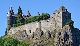
Andelat is a French commune in the Cantal department in the Auvergne region of south-central France.
Contents
Map of Andelat, France
Geography
Andelat is located some 4 km north-west of Saint-Flour. It can be accessed by the D679 road which passes through the east of the commune going north from Saint-Flour to Talizat. The D40 road also goes north-west from Saint-Flour passing just south of the village and continuing north-west through the commune to Coltines. The D404 road also comes south from Talizat to intersect the D40 road in the commune then continues south to Roffiac. Andelat village can only be reached by small country roads from the D40 and the D679. There are a number of other villages and hamlets in the commune. These are: Barret, Pagros, Sebeuge, and Le Sailhant. Apart from a number of small forests (the Bois du Sailhant, Bois de Ferval, Les Bessieres) and some scattered areas of trees the commune is entirely farmland.
A railway line passes through the commune from Saint-Flour in the south east and continuing to the north.
The Ander river flows through the commune from west to east just south of the village and continues south-west to join the Truyere near Anglards-de-Saint-Flour. The Ruisseau de la Souche rises in the north of the commune and flows south-west to join Le Babory which flows from the north of the commune. The Ruisseau de Ferval also joins Le Babory further downstream. Le Babory continues south to join the Ander in the commune.
History
Andelat was chosen by King John to be, since 1360, the seat of the Bailiwick of the Auvergne Mountains. He knew the name of the particular jurisdictions and made it subordinate to the Seneschal of Riom. The magistrates found that the village was unworthy of their offices and made it a traveling seat holding hearings in rented rooms at Chaudes-Aigues and Roffiac, and sometimes at the royal castle at Bredon, now in ruins, in the current commune of Albepierre-Bredons. The seat was transferred by François I in 1491 to Murat without reuniting it with its bailiwick and retained its name of Bailiwick of Andelat.
Administration
List of Successive Mayors
(Not all data is known)
Demography
In 2009 the commune had 436 inhabitants. The evolution of the number of inhabitants is known through the population censuses conducted in the commune since 1793. From the 21st century, a census of communes with fewer than 10,000 inhabitants is held every five years, unlike larger towns that have a sample survey every year.
Sources : Ldh/EHESS/Cassini until 1962, INSEE database from 1968 (population without double counting and municipal population from 2006)