
Elevation 25 m (82 ft) Area 150 ha Area code +674 | Time zone (UTC+12) Population 452 (2011) | |
 | ||
Geography
It is part of the Anabar Constituency. It is located in the northeast of the island, covers an area of 1.5 km² and has a population of 452 (2011).
History
Anabar, along with neighboring district of Ijuw, are believed to be the 3rd areas to submerged after Buada first and Anibare second about 3000+ years ago.
Its first inhabitants are Deiboe clans people, led by Deianoang, who fled to save his family of three daughters, from the raging war of Atemor's open field between Eamwit clans men off Anuquoge village and his clan, the Deiboe people from Ganokoro.
Irutsi clan was born amongst the rocky regions of Abodeatsi where three men slaves and two slave women met during a month-long hide amidst the rocky region, who five slave people later intermarried each other to expand the population along the rocky regions of Anabar.
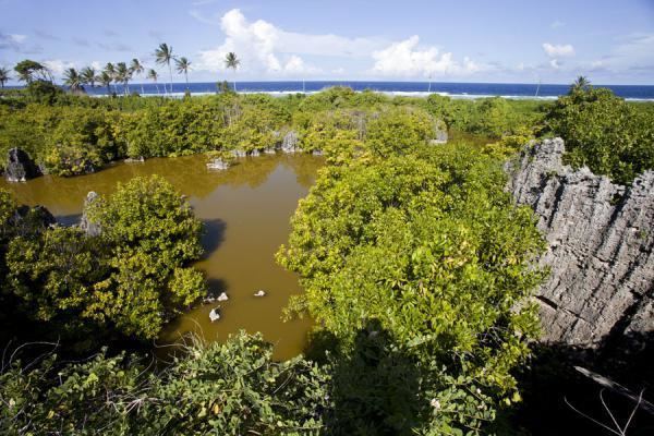
Anabar's pond 'Tibinor' was the deepest pond on the island. Such legends like the ones of 'Amwieob' originated in Anabar.
Like Buada, Anabar had its own dialect, a way of speaking which the natives refer to as the "Kin'nir", nothing similar to the "E'koro" language in the Arenibok village.