
Location Canton of Berne Primary inflows Catchment area 4.202 km (1.622 sq mi) Surface elevation 641 m Length 1.1 km Width 500 m | Type natural Primary outflows Wahlenbach Area 38 ha Volume 0.002553 km³ | |
 | ||
Similar Dittligsee, Alps, Amsoldingen Castle, Hinterstockensee, Mattenalpsee | ||
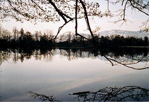
Amsoldingersee is small lake adjacent to the town of Amsoldingen, in the Upper Gürbetal. It is located near the city of Thun, Switzerland. The lake has a surface area of 38 hectares and a maximum length of 1.1 km and width of 500 m. The maximum depth is 14 m. It is fed by Rotmoos-Bach from the smaller Uebeschisee.
Map of Amsoldingersee, 3633 Amsoldingen, Switzerland
References
Amsoldingersee Wikipedia(Text) CC BY-SA