
Carries 4 lanes Official name Ponte de Amizade Design Cable-stayed bridge Total length 3,900 m Width 18 m Location Macau Peninsula | Crosses Praia Grande Bay Other name(s) New Macau-Taipa Bridge Address Pte. da Amizade, Macau Opened March 1994 Body of water Praia Grande Bridge type Cable-stayed bridge | |
 | ||
Locale Macau Peninsula and Taipa Similar Governador Nobre de Carvalho, Sai Van Bridge, Macau Peninsula, A‑Ma Temple, Fortaleza do Monte | ||
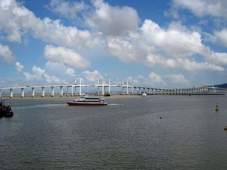
The Amizade Bridge is a four-lane, two-way bridge in Macau that connects Macau Peninsula near the Reservatório and Taipa Island at Pac On.
Built after the Macau-Taipa Bridge, it is the second one that connects the peninsula and Taipa across the Zhujiang River Estuary. Thus it is also referred to as the New Macau-Taipa Bridge.
Construction started in June 1990. Opened to traffic in March 1994, it is the longest of the three bridges crossing Baía da Praia Grande between Macau Peninsula and Taipa, with a length of 4.7 kilometers (2.9 mi), including 800 meters (2,625 ft) of connecting viaduct, and a width of 18 metres. There are two crests on the bridge to allow for the passage of sea traffic. The highest point of the bridge is 30 meters (98 ft) above sea level. The two entrances on the peninsula are at Avenida de Amizada near the Hong Kong-Macau Ferry Terminal and at Avenida da Ponte da Amizade in Areia Preta. The two entrances on the northern slope of Taipa Grande are at Estrada de Pac On, that connects to Pac On, and at Estrada Almirante Magalhães Correia, that connects with the Centro of Taipa (Vila da Taipa).