
Postcode(s) 3371 Postal code 3371 Federal division Division of Bendigo | Local time Wednesday 6:12 AM | |
 | ||
Location 173 km (107 mi) NW of Melbourne58 km (36 mi) N of Ballarat5 km (3 mi) W of Talbot Weather 18°C, Wind SE at 8 km/h, 50% Humidity | ||
Amherst a town in Victoria, Australia is now located in what is known as the Shire of Central Goldfields, northwest of Talbot. The town's location now resembles an uneven paddock of some 10 acres (40,000 m2), but has little showing of its startling and significant historical prevalence. The town began as a mining settlement which was referred to as Daisy Hill, or sometimes Daisy Hill Creek, and extended throughout the village. After a discovery of gold during the Gold Rush of 1853, the location became known as an extremely rich goldfield soon thereafter. Prior to this discovery, Daisy Hill had gained a particular notoriety, due to an illegal gold rush in February 1849, that was based solely upon the spurious claims made by on Thomas "Tommy" Chapman, a shepherd and former Parkhurst prison delinquent. It has been said that Chapman sold a gold nugget substantial in size, and relative to that of an adult hand, to a Melbourne Jeweller, Mr. Bretani from Collins Street. Soon after this alleged sale, Chapman mysteriously vanished. Much confusion surrounds where Chapman actually found the nugget, or if in fact, he stole it, according to the March 1849 issue of the Maitland Chronicle newspaper. As for his disappearance, a number of shepherds used the alias of Thomas Chapman.
Map of Amherst VIC 3371, Australia
The two principal colonial towns of Geelong and Melbourne were involved in the gold fever hype, since the California rush had also started, with the discovery of Daisy Hill, as was reported in local newspapers between February and March 1849. Because the actual location of Daisy Hill is still unknown, it often gets confused with a land division nearby in the Paddy Ranges known as the Daisy Hill Block, which was an earlier squatter survey lease in the Pyrenees. In addition to this, the Colonial Police Troopers were stationed at a place that had been widely known to be to referred to as Daisy Hill in 1849, which is located on the highway to Maryborough. However, newspapers of the period often loosely referred to Cluned Station, some 10 miles (16 km) east as the "Pyrenees".
The village name actually comes from a mining camp which saw tens of thousands of miners rush the area, and changed the name from Daisy Hill to Amherst in 1855, after the area was surveyed. With a Post Office opening in January 1856, (closed 1963), Amherst eventually became a municipality in 1858, which included the town of Talbot (formerly known as Back Creek, for rioting miners in 1855).
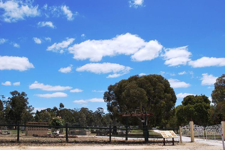
Talbot increased in size and eventually replaced Amherst as the municipality. Much of the original township has been destroyed by bushfire, and little remains other than the Amherst Cemetery. Due to years of isolation, time stood still for Talbot as it exhibits the charm of restored buildings dating back to its thriving heyday.