
- elevation 5,241 ft (1,597 m) - average 233 cu ft/s (7 m/s) Length 32 km Country United States of America | - elevation 2,765 ft (843 m) - min 15 cu ft/s (0 m/s) Discharge 6.598 m³/s | |
 | ||
- max 6,280 cu ft/s (178 m/s) | ||
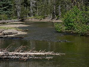
The American River is a tributary of the Naches River, in Washington in the United States. It flows down the east side of the Cascade Range, through Wenatchee National Forest and the William O. Douglas Wilderness.
Map of American River, Washington, USA
From its source at American Lake, it flows north for several miles, picking up its tributary the Rainier Fork American River, which flows east down from the vicinity of Chinook Pass. State Route 410 crossing Chinook Pass from Mount Rainier National Park, then follows the Rainier Fork and the American River valleys.
After its confluence with Rainier Fork, the American River flows through Pleasant Valley. It joins the Bumping River at its confluence within the American Forks Campground and they become the Naches River.
The American River is part of the Columbia River basin, being a tributary of the Naches River, which is tributary to the Yakima River, which is tributary to the Columbia River.
An early name for the American River was Miners Creek. According to historian Gretta Gossett, the river was renamed for the American River in California, "by hopeful miners".