
 | ||
The American Battlefield Protection Program (ABPP) is a US federal government program created by the Secretary of the Interior in 1991, with the aim of preserving historic battlefields in the United States. In 1996, Congress signed into law the American Battlefield Protection Act, which officially authorized the ABPP. The program operates under the American Battlefield Protection Program Authorization as of 2009.
Contents
- Battlefield Preservation Studies
- State by State Updates to the Civil War Sites Advisory Commission Report 2011
- Revolutionary War and War of 1812 Study 2007
- Mexican American War Battlefields 2004
- Civil War Sites Advisory Commission Report on the Nations Civil War Battlefields 1993
- Shenandoah Valley Study 1992
- Grants
- Definitions
- Battlefield Survey Methodology
- Military Terrain Analysis
- Key and Decisive Terrain
- Observation and Field of Fire
- Cover and Concealment
- Obstacles
- Avenue of ApproachWithdrawal
- Defining Features
- Battlefield Boundaries
- Core Area Boundaries
- POTNR boundaries
- Assessing a Battlefields integrity
- References
The American Battlefield Protection Program (ABPP) promotes the preservation of significant historic battlefields associated with wars on American soil. The goals of the program are 1) to protect battlefields and sites associated with armed conflicts that influenced the course of our history, 2) to encourage and assist all Americans in planning for the preservation, management, and interpretation of these sites, and 3) to raise awareness of the importance of preserving battlefields and related sites for future generations. The ABPP focuses primarily on land use, cultural resource and site management planning, and public education.
Battlefield Preservation Studies
At the direction of Congress the American Battlefield Protection Program has periodically identified, surveyed, and assessed the preservation needs at significant sites associated with the American Revolution, the Civil War, and the War of 1812.
In addition to these studies, the ABPP has either undertaken or supported the identification, survey, and assessment of many other battles associated with additional wars ranging from 16th-century contact encounters to World War II actions in the Pacific.
State by State Updates to the Civil War Sites Advisory Commission Report (2011)
Congress authorized the Civil War Battlefield Preservation Act of 2002 tasking the American Battlefield Protection Program with producing an update to the 1993 Civil War Sites Advisory Commission Report on the Nation’s Civil War Battlefields. Congress required that the update address 1)preservation activities carried out at the battlefields since 1993 2) changes in the condition of the battlefields since 1993 and 3)any other relevant developments relating to the battlefields since 1993.
The American Battlefield Protection Program produced 25 updated reports, by state. The purpose of the reports are to presents information about Civil War battlefields for use by Congress, federal, state, and local government agencies, landowners, and other interest groups to enable them to act quickly and proactively to preserve and protect nationally significant Civil War battlefields; and to create partnerships among state and local governments, regional entities, and the private sector to preserve, conserve, and enhance nationally significant Civil War battlefields.
Revolutionary War and War of 1812 Study (2007)
Congress authorized the The Revolutionary War and War of 1812 Historic Preservation Study in 1996 because many historic sites of the American Revolutionary War and War of 1812 were at risk from rapid urban or suburban development. The goals of the study were 1) to gather current information about the significance of, current condition of, and threats to the Revolutionary War and War of 1812 sites and 2) to present preservation and interpretation alternatives for the sites.
The American Battlefield Protection Program identified and documented 677 significant places associated with the Revolutionary War and War of 1812. The 2007 Report to Congress on the Historic Preservation of Revolutionary War and War of 1812 Sites in the United States presented information about at-risk Revolutionary War and War of 1812 battlefields and associated properties for consideration by Federal, State, tribal, municipal, non-profit, and private entities.
Mexican American War Battlefields (2004)
The National Park Service, Cultural Resources Geographical Information System Facility (CRGIS) undertook, on behalf of the American Battlefield Protection Program, a study of the significant Mexican–American War battlefields in the United States. CRGIS identified thirteen battlefields in California, New Mexico, and Texas. Each battlefield was documented, battlefield boundaries were drawn, and each site was assessed for threats, integrity, and preservation needs. CRGIS presented maps and final assessments for each battlefield to the American Battlefield Protection Program in 2004.
Civil War Sites Advisory Commission Report on the Nation's Civil War Battlefields (1993)
Congress established the Civil War Sites Advisory Commission in 1990 to identify significant Civil War sites, determine their condition, assess threats to their integrity, and offer alternatives for their preservation and interpretation. Because of limited time and resources, the Commission concentrated on battlefields as the central focus of the Civil War, and of many contemporary historic preservation decisions.
The Commission identified 384 battlefields as the principal battles of the war and classified them according to their historic significance. The battlefields were surveyed and assessed for landscape integrity, threats, and preservation needs. A final report was presented to Congress in 1993. The Commission sunset in 1993, however, the American Battlefield Protection Program continues to implement parts of the Commission's mission and recommendations.
Shenandoah Valley Study (1992)
In 1990 Congress authorized a study of Civil War sites in the Shenandoah Valley of Virginia. The study was to accomplish four tasks: identify significant Civil War sites and determine their condition, establish their relative importance, assess short and long term threats to their integrity, and provide alternatives for their preservation and interpretation by Federal, State, and local governments, or by other public or private entities.
The study defined the Shenandoah Valley as comprising eight Virginia counties—Augusta, Clarke, Frederick, Highland, Page, Rockingham, Shenandoah, and Warren. Fifteen battle events of major significance were identified and documented and a final report detailing each battlefields' landscape integrity, risk, and preservation needs was presented to Congress in 1992.
Grants
The American Battlefield Protection Program administers two separate grant programs:
• Battlefield Planning Grants are awarded annually to groups, institutions, organizations, or governments sponsoring preservation projects such as Site Identification and Documentation, Planning and Consensus Building, or Interpretation and Education at historic battlefields. Any battlefield on American soil is eligible for this grant. Since 1993, the ABPP and its partners have helped protect and enhance more than 100 battlefields by co-sponsoring 513 grant projects in 42 states and territories. The ABPP encourages, but does not require, matching funds or in-kind services to these projects.• Civil War Battlefield Land Acquisition Grants are awarded to state and local governments for the fee simple acquisition of Civil War battlefield land, or for the acquisition of permanent, protective interests (easements) in Civil War battlefield land. Each grant requires a dollar-for-dollar non-Federal match. Only Civil War battlefields listed in the Civil War Sites Advisory Commission's (CWSAC) 1993 Report on the Nation's Civil War Battlefields are eligible for this grant.Definitions
In order to focus closely on battlefield lands and their associated properties, the American Battlefield Protection Program has developed program specific definitions for both property types that help them meet their stated mission of promoting battlefield preservation. The definitions are:
• Battlefield Land - Sites where armed conflict, fighting, or warfare occurred between two opposing military organizations or forces recognized as such by their respective cultures (not civil unrest).• Associated Sites - Sites occupied before, during, or after a battle at which events occurred that had a direct influence on the tactical development of the battle or the outcome of the battle. A site must be associated with a battle in order to be considered an Associated Site.Battlefield Survey Methodology
Over the past 20 years, the American Battlefield Protection Program has devised and refined a methodology for identifying and mapping battlefield landscapes. The methodology consists of applying the concepts of Military Terrain Analysis to a battlefield to identify its terrain; identifying the Defining Features of a battlefield; drawing a Study and Core area to delineate the historic boundaries of a battlefield; and assessing the integrity of the landscape (Areas of Integrity) using the National Register of Historic Places Bulletin 40: Guidelines for Identifying, Evaluating, and Registering America's Historic Battlefields.
Military Terrain Analysis
Military Terrain Analysis is a process used by the military both to describe the terrain of the battlefield environment and to analyze the significance of the terrain. By studying the military significance of the terrain a person can identify the historic battlefield "hidden" in the modern landscape. Military terrain is analyzed using five key aspects (commonly referred to by various acronyms such as KOCOA, OAKOC, and OCOKA):
• Key Terrain/Decisive Terrain• Observation and Fields of Fire• Concealment and Cover• Obstacles• Avenues of Approach/WithdrawalKey and Decisive Terrain
Key Terrain ~ any ground which, when controlled, gives a marked advantage to either combatant. Two factors can make terrain key: how a commander chooses to use it, and whether his enemy can use it to defeat the commander's forces.Key terrain typically offers control of a local objective or an important transportation route. Examples: high ground with good observation and fields of fire; transportation choke-point such as a water crossing, mountain gap, or road junction.Decisive Terrain ~ also called Critical Terrain. Ground that must be controlled in order to successfully accomplish the mission. Decisive terrain is relatively rare and is not necessarily associated with a formal Course of Action or present in every situation. Terrain is identified as decisive when it is recognize that the mission depends upon its seizure or retention.There may be several key terrain features in an area of operation, however, not every mission will have decisive terrain.Observation and Field of Fire
Observation ~ the ability to see friendly and enemy forces and key aspects of the terrain in order to judge strength, prevent surprise, and respond to threats.Observation may be unaided - how far one can see from a position with the naked eye, or aided - looking from a position with the aid of binoculars, infrared, night-vision devices, thermal imaging devices, etc.Field of fire ~ an area that weapons may cover/fire upon effectively from a given position. A person or unit's field of fire is directly related to Observation.Dead Space ~ an area within the maximum range of a weapon or observer, which cannot be covered or seen from a particular position.Cover and Concealment
Cover ~ protection from enemy fire. Example - ditches, riverbanks, buildings, walls, entrenchmentsConcealment ~ protection from enemy observation and surveillance. Example - forests, ravines, dense vegetation, reverse slopesConcealment and Cover limit Observation and Field of Fire.Obstacles
Obstacles ~ natural or man-made terrain features that prevent, impede, or divert military movementThere are two categories of Obstacles: existing and reinforcing:Existing obstacles are already present on the battlefield and not placed there through military effort. They can be natural (swamp, forest, river) or cultural (town, railroad, bridge).Reinforcing obstacles are placed on the battlefield through military effort and are designed to strengthen the terrain. Reinforcing obstacles include such things as entrenchments, earthworks, and abatis.The presence and difficulty of obstacles determine whether terrain is:Avenue of Approach/Withdrawal
Avenue of Approach ~ relatively unobstructed ground route that leads to an objective or to key terrainAvenue of Withdrawal ~ relatively unobstructed ground route that leads away from an objective or key terrainMobility Corridor ~ area where movement is channeled due to terrain constrictions, e.g., road over a causeway, mountain passThe size of an attacking unit is limited by the breadth and difficulty of its Avenue of Approach.Defining Features
Once the general area of the battlefield has been identified the next step is to identify features that are associated with the battle and help define the overall battlefield landscape.
Features on a battlefield consist of natural terrain features, man-made features, and place names found in battle descriptions or on historic maps that can be used to locate significant actions and events associated with a battle. An example of a feature on a battlefield may be a place such as a town or farm; a structure such as a mill, house or church, a road, wood lot, earthwork, or farm field; or a natural terrain feature, such as a stream, ridge, hill, ford, or ravine.
Defining Features are features that, in addition to being found in battle descriptions and on historic maps, can be visually located on the modern landscape or under the landscape’s surface (archeological remains). This is an important distinction as Defining Features must be topographically defensible. Any feature whose existence can be verified through physical evidence can be mapped as a Defining Feature. Features that no longer exist above or below the surface and therefore have no physical trace are still considered battle features but are not mapped as Defining Features.
Defining Features not only define the battlefield on the landscape but also serve to pin battle events to identifiable locations. They aid in establishing legitimate, historically defensible boundaries around a battlefield landscape and are legitimate historic resources that are supported by historical evidence and source materials. Finding and mapping Defining Features helps to ensure that the battlefield is defined as objectively as possible and to accurately reflect the full extent of the battlefield on the modern landscape.
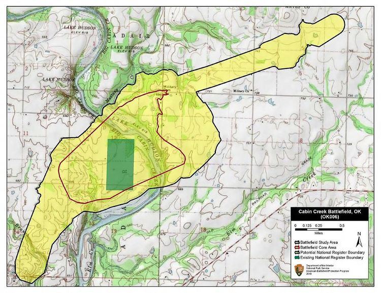
Battlefield Boundaries
Study and Core Area boundaries delineate the historical extents of a battlefield. POTNR boundaries delineate areas within the Study and Core Area(s) that still retain integrity and remain to be preserved. The Study and Core Area boundaries define the historic landscape of the battlefield while areas that retain integrity define the modern landscape. For example, if a particular farm field was important during the battle but now is covered by a housing development, it would still be included in a Core or Study Area boundary because the farm field informs the history of the battle. That same farm field, however, would not be considered for inclusion in an POTNR boundary because it no longer has integrity (i.e. conveys a sense of the historic scene) and there is nothing left of the original farm field to preserve.
When surveying a battlefield the Study and Core Areas are identified first and then the portions of those Areas that retain integrity (PotNR) are identified and delineated.
Battlefield Boundaries
The Battlefield Boundary (formerly known as the Study Area) defines tactical context and visual setting and reflects the historic extent of the battle as it unfolded across the landscape. The Study Area contains all resources and related to or contributing to the battle event: where troops maneuvered and deployed, immediately before, during, and after combat, and where they fought during combat. The Study Area also includes all locations and geographic features that directly contributed to the development and ending of the battle (Defining Features).
The Battlefield Boundary should include the following:
• Core Areas of combat (see Core Area below);• Minor preliminary skirmishing if it led directly to the battle;• Approach and Withdrawal routes of the military units. These should be drawn as corridors along the roads if movement was confined to a road, if not they should be drawn as corridors along the landscape if those corridors are known. In order to standardize corridors of movement along the routes, Infantry routes are buffered at 200 yeards in width and Cavalry routes are buffered at 400 yards in width. These widths are roughly the frontage of an average regiment;• Areas of maneuver and locations of deployed units on the field, even if these units were not engaged;• Routes and locations of any units held off or sent out of range of the fighting (e.g. scouting) during the battle. Units that engaged in combat with enemy forces as a result of being held off or sent out of range should be included in a Core Area;• Minor post battle skirmishing if it was part of a larger withdrawal;• Geographic features that contribute to the flow of battle (mountains, ravines, hills, rivers, etc.);• Encampments (if they were part of the initial position of the attacking/defending force(s)); and• Logistical areas - e.g. locations of ammunition trains, hospitals, headquarters, supply dumps.The Battlefield Boundary is restricted to the immediate flow of battle after one side or the other has moved to initiate combat. For example, if a unit left its encampments intending to attack the enemy, it is appropriate to include the encampments and the accompanying approach routes in the Study Area as the initial position of the attacking force. The route of the previous day's march to reach those encampments, however, would not be included.
The Battlefield Boundary ends where the opposing forces disengaged and withdrew. Reasons for disengagement might include darkness or adverse weather conditions, pursuit of a retreating force being halted by a rear guard action, orders to disengage being received, or one force accomplishing its objective and choosing not to pursue its retreating foe. Withdrawal routes end where, logically, the combatants would not be expected to turn back and continue engaging in battle.
There is only one contiguous Battlefield Boundary per battlefield. The Battlefield Boundary is generally drawn, where practicable, to follow natural features and contours identified on USGS 7.5 minute quadrangle maps.
Core Area Boundaries
The Core Area of a battlefield is the area of direct combat on the battlefield. A Core Area includes critical land where fighting occurred and casualties were sustained. There may be multiple Core Area boundaries on a battlefield, but all must fall fully within the Battlefield boundary. Of note when drawing Core Area boundaries:
• As a rule, the position of any unit that fired weapons or that came under fire is included within Core Area boundaries; however, minor skirmishing along approach or withdrawal routes is not included as it detracts from the primary area(s) of combat. It is, however, included in the larger Study Area boundary.• Units held or sent out of range are generally not included within Core Area boundaries unless their being sent out of range caused them to engage in fighting with opposing forces.For example, a unit was sent, during the battle, to verify reports of enemy forces being sited at a location removed from the main area of combat. If no enemy forces were found or engaged, the unit’s movements from and back to the main area of combat would be included in the Study Area boundary. If the unit found and engaged opposing forces, however, the action would be considered direct combat and would receive its own Core Area boundary.
Artillery positions are generally not included within Core Area boundaries unless they are attacked, give supporting fire, or are directly engaged in fighting with opposing forces.
For example, if cannons were massed to cover a road and their position led to an engagement through cannon fire or a direct attack on the guns, then the position would be included in a Core Area boundary. If, however, the cannons were not engaged but their mere presence caused the opposing force to move on a different road, then their position would be considered as playing a strategic role in the overall battle and would be included in the larger Battlefield Boundary.
Core Area boundaries are generally drawn, where practicable, to follow natural features and contours identified on USGS 7.5 minute quadrangle maps.
POTNR boundaries
"Integrity is the ability of a property to convey its significance." (NRHP Bulletin 40)
Unlike the Battlefield and Core Area boundaries, which are based only upon the interpretation of historic events (historic landscape), Area of Integrity boundaries, also referred to as Potential National Register (POTNR) boundaries, are based on an assessment of the current landscape's integrity (modern landscape) using the guidelines outlined in National Register Bulletin 40. The boundaries drawn around these areas encompass lands that retain their historic integrity and either are already preserved or could be preserved in the future. These boundaries must fall fully within the Battlefield Boundary. In some cases the battlefield landscape will no longer retain any integrity; therefore some battlefields will not have a POTNR boundary.
Assessing a Battlefield’s integrity
The degree to which post-war development has altered and fragmented the historic battlefield landscape or destroyed historic features and viewsheds is critical when assessing a battlefield’s current integrity. Of note when assessing integrity:
• Changes in traditional land use over time do not generally diminish a battlefield’s integrity. For example, landscapes that were farmland during the battle do not need to be in agricultural use today to be considered eligible for listing in the NRHP so long as the land retains its historic rural character. Similarly, natural changes in vegetation – woods growing out of historic farm fields, for example – do not necessarily lessen a landscape’s integrity.• Some post-battle development is expected; slight or moderate change within the battlefield may not substantially diminish a battlefield’s integrity. A limited degree of residential, commercial, or industrial development is acceptable. These post-battle "non-contributing" elements are often included in the POTNR boundaries in accordance with NRHP guidelines.• Significant changes in land use since the time of the battle do diminish the integrity of the battlefield landscape. Heavy residential, commercial, and industrial development; cellular tower and wind turbine installation; and large highway construction are common examples of such changes. Battlefield landscapes with these types of changes are generally considered as having little or no integrity and will be excluded from the PotNR boundary.The concept of integrity for the purpose of drawing POTNR boundaries is defined in NRHP Bulletin 40: Guidelines for Identifying, Evaluating, and Registering America's Historic Battlefield (Section VII - Assessing Integrity).