
Time zone CET (UTC+1) Area 11.22 km² Population 503 (2013) | County Csongrád Postal code 6916 Local time Tuesday 8:01 AM Area code 62 | |
 | ||
Weather 7°C, Wind S at 16 km/h, 83% Humidity | ||
Ambr zfalva falukar csony 2014 12 20 a legapr bbak ovisok mikul s t nca
Ambrózfalva is a village in Csongrád County, in the Southern Great Plain region of southern Hungary.
Contents
- Ambr zfalva falukar csony 2014 12 20 a legapr bbak ovisok mikul s t nca
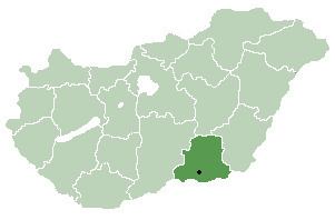
- Map of AmbrC3B3zfalva 6916 Hungary
- Star dance ambr zfalva bredj mellettem 2014 05 01 v gegyh za maj lis
- Geography
- Demographic
- Coat of arms
- References
Map of Ambr%C3%B3zfalva, 6916 Hungary
Star dance ambr zfalva bredj mellettem 2014 05 01 v gegyh za maj lis
Geography
It covers an area of 11.22 km2 (4 sq mi) and has a population of 503 people (2013 estimate).
Demographic
Ambrózfalva's population declared themselves as 86% Hungarian nationality, 13% Slovak nationality, and 1% Romanian nationality in a 2001 census.
Coat of arms
The coat of arms of Ambrózfalva has two images: three ears of corn on the left side, and a patriarchal cross on the right. The three ears of corn act as a reference to the agricultural characteristics of the village and the area. The golden ears of corn symbolize the ancestors' settling in and also represents their success. The patriarchal cross is similar to that of the coat of arms of Slovakia and is a reminder of the Slovak origin of the population of the area. It also represents the importance of recognizing national and ethnic traditions.